More Rain on the Way with Severe Weather Possible Saturday

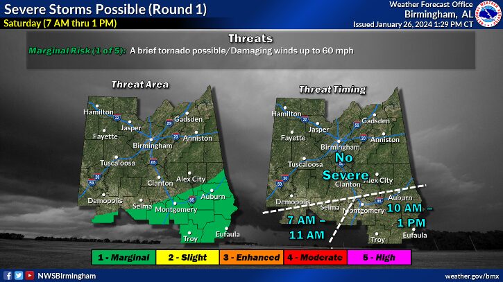
According to the National Weather Service in Birmingham, another round of showers and storms will begin to move in late tonight and tomorrow morning with a Level 1 out of 5 risk of severe storms in southern areas of the state with the morning round, which won’t impact the Cherokee County area.

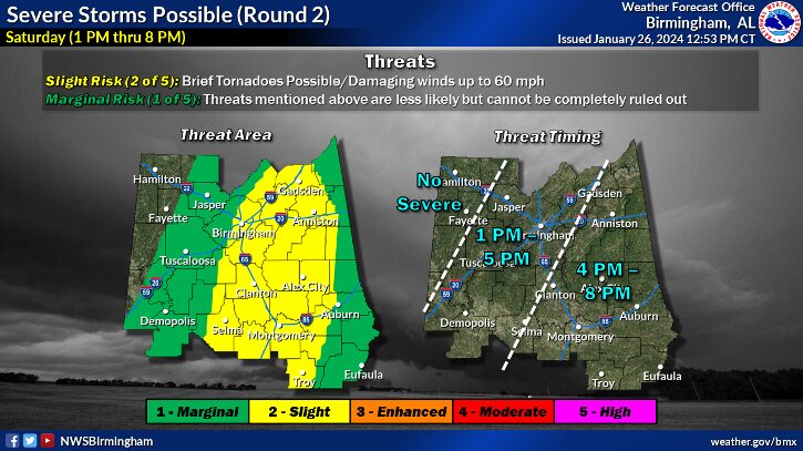
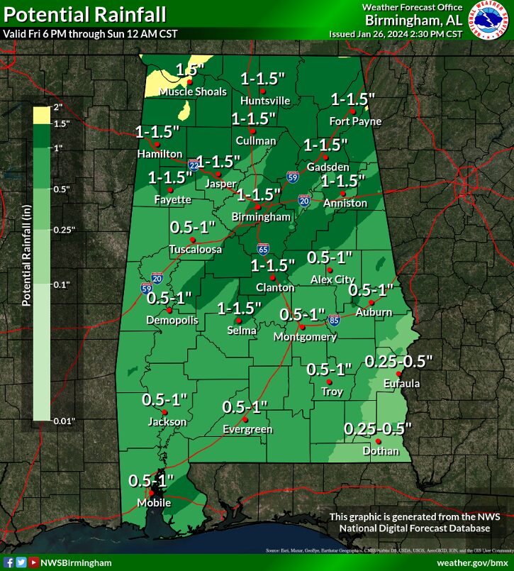
However, a second round of severe storms with up to a Level 2 out of 5 risk may materialize in the afternoon in our area, but this will be contingent on IF we get enough heating behind the morning storms. Stay tuned for updates tomorrow. Also, given how wet it has been this week, the additional rainfall may cause flooding.

There is a slight risk (level 2 of 5) for severe storms Saturday afternoon and evening. Damaging winds and a brief tornado are possible.
Additional rainfall expected of 1 to 2 inches with locally higher amounts through Saturday afternoon. This is on top of the of the 2 to 4 inches of rain that has already occurred over the last 2 days. This may result in additional flooding, especially for areas along and north of Interstate 85. River Flooding will also continue.
Many people underestimate the power of water. Steer clear of flooded roads. Almost half of flood deaths happen in vehicles. If you encounter a flooded road, remember “Turn Around, Don’t Drown!”
Increasing showers and storms will begin to arrive in the west after Midnight. Lows will range from the middle 50s north to lower 60s south.
Widespread rain and storms possible in the first half the day. The activity will then move to the east for the afternoon and early evening. Highs will be the 60s to low 70s.

Stay tuned to WEIS 100.5 FM and 990 AM for the latest weather updates.

Share on facebook
Facebook
Share on twitter
Twitter
Share on linkedin
LinkedIn
Share on email
Email
Share on print
Print