

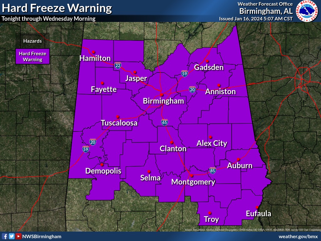
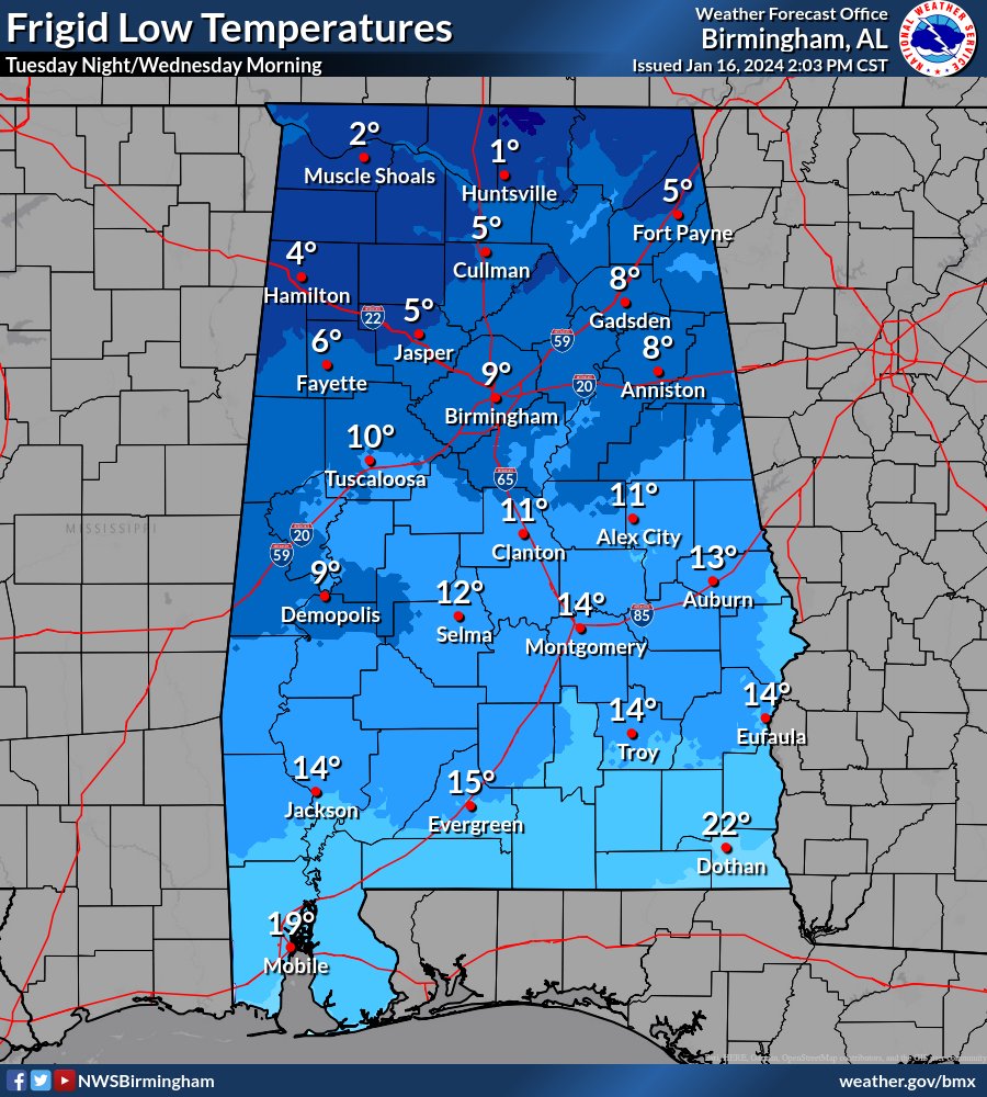
Hard Freeze Warning
URGENT - WEATHER MESSAGE
National Weather Service Birmingham AL
416 AM CST Tue Jan 16 2024

ALZ011>015-017>028-030>036-039-162200-
/O.CON.KBMX.HZ.W.0001.000000T0000Z-240117T1600Z/
Marion-Lamar-Fayette-Winston-Walker-Blount-Etowah-Calhoun-
Cherokee-Cleburne-Pickens-Tuscaloosa-Jefferson-Shelby-St. Clair-
Talladega-Clay-Sumter-Greene-Hale-Perry-Bibb-Chilton-Coosa-
Marengo-
Including the cities of Hamilton, Sulligent, Vernon, Fayette,
Double Springs, Jasper, Oneonta, Gadsden, Anniston, Centre,
Heflin, Carrollton, Tuscaloosa, Birmingham, Hoover, Columbiana,
Pelham, Alabaster, Pell City, Moody, Talladega, Sylacauga,
Ashland, Livingston, Eutaw, Greensboro, Moundville, Marion,
Centreville, Clanton, Rockford, Demopolis, and Linden
416 AM CST Tue Jan 16 2024

...HARD FREEZE WARNING REMAINS IN EFFECT UNTIL 10 AM CST
WEDNESDAY...

* WHAT...Temperatures will range from around 8 northwest to 20
  central this morning, then remain at or below freezing in many
  areas this afternoon, and drop into the 0 to 10 range tonight.

* WHERE...Northwest half of central Alabama.

* WHEN...Until 10 AM CST Wednesday.

* IMPACTS...Prolonged sub-freezing temperatures may cause pipes
  to burst. Bitterly cold temperatures and wind chills can
  result in hypothermia or frostbite. These conditions are life-
  threatening to those with prolonged exposure or without access
  to warmth.

PRECAUTIONARY/PREPAREDNESS ACTIONS...

Take steps now to protect tender plants from the cold. To prevent
freezing and possible bursting of water pipes they should be
wrapped, drained, or allowed to drip slowly. Those that have in-
ground sprinkler systems should drain them and cover above-ground
pipes to protect them from freezing.

You must be logged in to post a comment.