
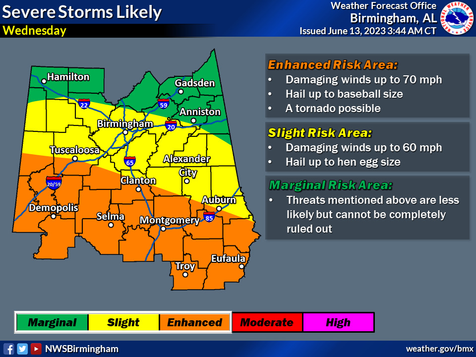
Overview:
Somewhat similar to the event we experienced earlier this year at the end of March – the weather system expected to affect our region on Tuesday and Wednesday will bring several rounds of severe thunderstorms posing a threat for large/damaging hail, damaging winds, flooding, and perhaps a tornado.
Changes from previous forecast:
Upgraded to an Enhanced Risk (level 3 of 5) for Wednesday.
Highlights:
Tuesday
* Where: All of Central Alabama
* When: Afternoon, possible lull during the evening, then another round overnight/generally after midnight
* Threats: Hail up to hen egg size (2″) and damaging winds up to 60mph, with a flood risk starting overnight
Wednesday
* Where: All of Central Alabama
* When: Multiple rounds during the morning, afternoon, and night
* Threats: Hail up to baseball size (2.75″), damaging winds up to 70 mph, perhaps a tornado, and flooding


You must be logged in to post a comment.