
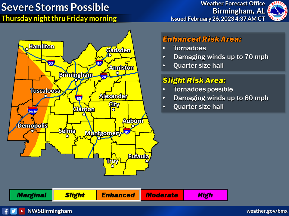
Tornadoes, wind gusts up to 70 mph, hail and flooding rain all look to be possible ahead of a cold front expected to approach Alabama in the Thursday night-Friday morning timeframe.
The National Weather Service said the timing is still uncertain but will become more clear in the next few days.
NOAA’s Storm Prediction Center has added a severe weather risk for all of Alabama on Thursday and an enhanced risk for parts of west Alabama. The severe weather risk stretches into Friday for eastern Alabama.
The National Weather Service will also be on the lookout for flooding later this week.
Forecasters said several rounds of rain are expected from Wednesday through Friday, and it could add up to 4 inches or so for parts of the state.
Stay tuned to the forecast through the week for potential changes to timing and the threat level.


You must be logged in to post a comment.