
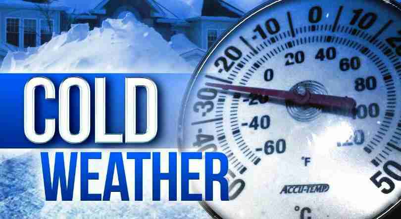
 Wind Chill Warning
URGENT – WINTER WEATHER MESSAGE
National Weather Service Birmingham AL
400 AM CST Thu Dec 22 2022
ALZ011>015-017-018-020-024-026-222100-
/O.CON.KBMX.WC.W.0001.221223T0600Z-221223T1800Z/
/O.CON.KBMX.WC.Y.0001.221223T1800Z-221224T1800Z/
Marion-Lamar-Fayette-Winston-Walker-Blount-Etowah-Cherokee-
Jefferson-St. Clair-
Including the cities of Hamilton, Sulligent, Vernon, Fayette,
Double Springs, Jasper, Oneonta, Gadsden, Centre, Birmingham,
Hoover, Pell City, and Moody
400 AM CST Thu Dec 22 2022
…WIND CHILL WARNING REMAINS IN EFFECT FROM MIDNIGHT TONIGHT TO
NOON CST FRIDAY…
…WIND CHILL ADVISORY REMAINS IN EFFECT FROM NOON FRIDAY TO NOON
CST SATURDAY…
* WHAT…For the Wind Chill Warning, dangerously cold wind chills
expected. Wind chills as low as 10 below zero. For the Wind
Chill Advisory, very cold wind chills expected. Wind chills as
low as 5 below zero. Northwest winds at 12 to 25 mph with gusts
up to 40 mph are possible.
* WHERE…Northern third of central Alabama.
* WHEN…For the Wind Chill Warning, from midnight tonight to
noon CST Friday. For the Wind Chill Advisory, from noon Friday
to noon CST Saturday.
* IMPACTS…The extremely low wind chills could result in
hypothermia or frostbite if precautions are not taken.
PRECAUTIONARY/PREPAREDNESS ACTIONS…
Avoid outside activities if possible. When outside, make sure you
wear appropriate clothing, a hat, and gloves.
Use caution while traveling outside. Wear appropriate clothing, a
hat, and gloves.
Wind Chill Advisory
URGENT – WINTER WEATHER MESSAGE
National Weather Service Birmingham AL
400 AM CST Thu Dec 22 2022
ALZ011>015-017-018-020-024-026-222100-
/O.CON.KBMX.WC.W.0001.221223T0600Z-221223T1800Z/
/O.CON.KBMX.WC.Y.0001.221223T1800Z-221224T1800Z/
Marion-Lamar-Fayette-Winston-Walker-Blount-Etowah-Cherokee-
Jefferson-St. Clair-
Including the cities of Hamilton, Sulligent, Vernon, Fayette,
Double Springs, Jasper, Oneonta, Gadsden, Centre, Birmingham,
Hoover, Pell City, and Moody
400 AM CST Thu Dec 22 2022
…WIND CHILL WARNING REMAINS IN EFFECT FROM MIDNIGHT TONIGHT TO
NOON CST FRIDAY…
…WIND CHILL ADVISORY REMAINS IN EFFECT FROM NOON FRIDAY TO NOON
CST SATURDAY…
* WHAT…For the Wind Chill Warning, dangerously cold wind chills
expected. Wind chills as low as 10 below zero. For the Wind
Chill Advisory, very cold wind chills expected. Wind chills as
low as 5 below zero. Northwest winds at 12 to 25 mph with gusts
up to 40 mph are possible.
* WHERE…Northern third of central Alabama.
* WHEN…For the Wind Chill Warning, from midnight tonight to
noon CST Friday. For the Wind Chill Advisory, from noon Friday
to noon CST Saturday.
* IMPACTS…The extremely low wind chills could result in
hypothermia or frostbite if precautions are not taken.
PRECAUTIONARY/PREPAREDNESS ACTIONS…
Avoid outside activities if possible. When outside, make sure you
wear appropriate clothing, a hat, and gloves.
Use caution while traveling outside. Wear appropriate clothing, a
hat, and gloves.
Hard Freeze Warning
URGENT – WEATHER MESSAGE
National Weather Service Birmingham AL
352 AM CST Thu Dec 22 2022
ALZ011>015-017>050-222100-
/O.CON.KBMX.HZ.W.0001.221223T0600Z-221225T1500Z/
Marion-Lamar-Fayette-Winston-Walker-Blount-Etowah-Calhoun-
Cherokee-Cleburne-Pickens-Tuscaloosa-Jefferson-Shelby-St. Clair-
Talladega-Clay-Randolph-Sumter-Greene-Hale-Perry-Bibb-Chilton-
Coosa-Tallapoosa-Chambers-Marengo-Dallas-Autauga-Lowndes-Elmore-
Montgomery-Macon-Bullock-Lee-Russell-Pike-Barbour-
Including the cities of Hamilton, Sulligent, Vernon, Fayette,
Double Springs, Jasper, Oneonta, Gadsden, Anniston, Centre,
Heflin, Carrollton, Tuscaloosa, Birmingham, Hoover, Columbiana,
Pelham, Alabaster, Pell City, Moody, Talladega, Sylacauga,
Ashland, Roanoke, Livingston, Eutaw, Greensboro, Moundville,
Marion, Centreville, Clanton, Rockford, Alexander City,
Dadeville, Valley, Lanett, Lafayette, Demopolis, Linden, Selma,
Prattville, Fort Deposit, Hayneville, Wetumpka, Tallassee,
Montgomery, Tuskegee, Union Springs, Auburn, Opelika,
Phenix City, Troy, and Eufaula
352 AM CST Thu Dec 22 2022
…HARD FREEZE WARNING REMAINS IN EFFECT FROM MIDNIGHT TONIGHT TO
9 AM CST SUNDAY…
* WHAT…Sub-freezing temperatures as low as 5 to 12 will be
possible in northern portions of Central Alabama. Temperatures
as low as 10 to 15 will be possible in southern portions of
Central Alabama. Temperatures remain below freezing from late
Thursday night until at least midday Sunday. Far northern
portions of Central Alabama may remain below freezing until
Monday.
* WHERE…All of central Alabama.
* WHEN…From midnight tonight to 9 AM CST Sunday.
* IMPACTS…A prolonged period of subfreezing temperatures may
cause pipes to burst. Bitterly cold temperatures and wind
chills will result in hypothermia or frostbite and become life-
threatening to those with prolonged exposure or without
access to adequate warmth.
PRECAUTIONARY/PREPAREDNESS ACTIONS…
Take steps now to protect tender plants from the cold. To prevent
freezing and possible bursting of outdoor water pipes they should
be wrapped, drained, or allowed to drip slowly. Those that have
in-ground sprinkler systems should drain them and cover above-
ground pipes to protect them from freezing.
Hazardous Weather Outlook
Hazardous Weather Outlook
National Weather Service Birmingham AL
351 AM CST Thu Dec 22 2022
ALZ011>015-017>050-231300-
Marion-Lamar-Fayette-Winston-Walker-Blount-Etowah-Calhoun-Cherokee-
Cleburne-Pickens-Tuscaloosa-Jefferson-Shelby-St. Clair-Talladega-
Clay-Randolph-Sumter-Greene-Hale-Perry-Bibb-Chilton-Coosa-Tallapoosa-
Chambers-Marengo-Dallas-Autauga-Lowndes-Elmore-Montgomery-Macon-
Bullock-Lee-Russell-Pike-Barbour-
351 AM CST Thu Dec 22 2022
…BITTER COLD AND BLUSTERY CONDITIONS EXPECTED TONIGHT INTO
SUNDAY…
This Hazardous Weather Outlook is for the counties served by the
National Weather Service office in Birmingham.
.DAY ONE…Outlook through Tonight.
A bitterly cold air mass will move into Central Alabama late tonight.
Temperatures will drop into the single digits and teens late tonight
with wind chills as low as 0 to 15 below.
Sustained winds of 20 mph or greater will be possible late tonight
along and behind the cold front, with gusts of 35 to 40 mph.
Rain may briefly change over to light snow mainly across far
northern portions of Central Alabama tonight. Localized very light
accumulations are possible in far northern portions of Central
Alabama as temperatures quickly drop well below freezing.
.DAYS TWO THROUGH SEVEN…Friday through Wednesday.
A bitterly cold air mass will remain over Central Alabama for a few
days. Low temperatures Friday morning through Monday morning will be
in the single digits and teens. High temperatures will be in the
upper teens and 20s Friday. Below freezing temperatures will last 48
to 84 hours with the longest duration north. Wind chills readings
between 0 to 15 below are possible Friday morning through Saturday morning.
Sustained winds of 20 mph or greater with gusts of 35 to 40 mph will
remain possible Friday morning.
.SPOTTER INFORMATION STATEMENT…
Activation of storm spotters and emergency management is not
expected at this time.


You must be logged in to post a comment.