WEATHER UPDATE / WEDNESDAY, MAY 25th
More rainfall, and thunderstorms are in the forecast for Alabama today (Wednesday, May 25th) and a few of them could be severe. The National Weather Service radar is showing high rain chances in the forecast for much of the state The strongest storms could bring along damaging winds and hail. There is also a low risk for a tornado.
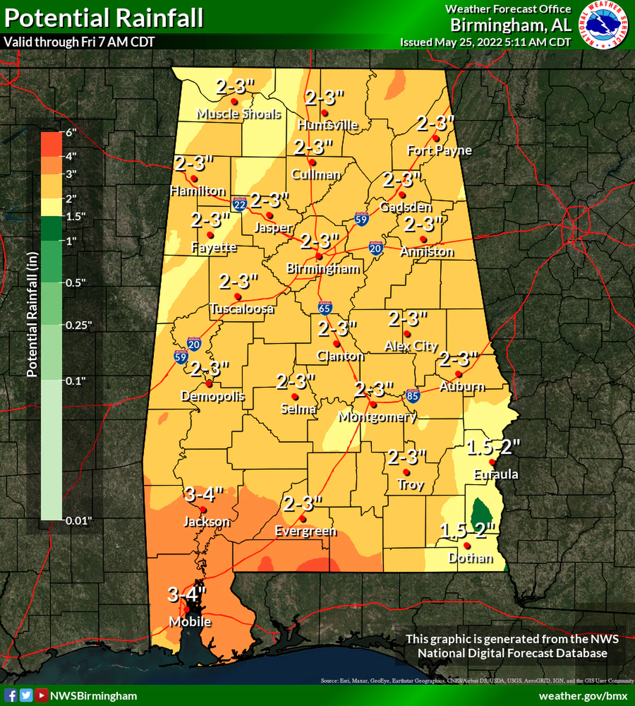
Heavy rain could be an issue, and a flood watch has been issued for the southwestern part of the state through Thursday. Many areas in Alabama could see 2 to 3 inches of rain, or more, through Friday morning.
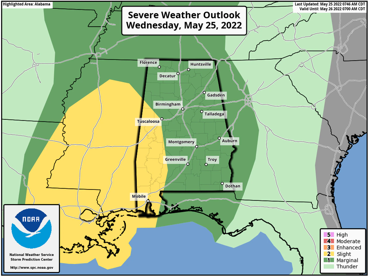
Soaking rainfall will be possible for portions of Alabama through Thursday night; the Storm Prediction Center has now upgraded the severe weather risk slightly for parts of west Alabama.
Some areas now have a Level 2 out of 5 risk for severe weather. That’s a slight risk, and it means that isolated severe storms will be possible. The remainder of the state still has a Level 1 out of 5 (or marginal) risk for severe weather. That marginal risk will also extend into Thursday for the entire state as a cold front approaches.
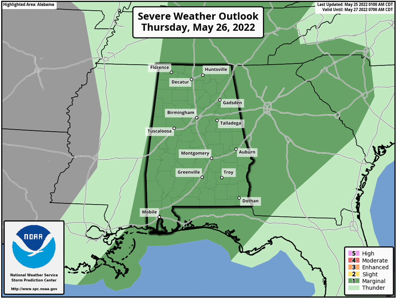
Thursday there will be another Level 1 risk for severe weather for all of Alabama.
Heavy rain will be possible, and it could add up to several inches and cause flooding in typically flood-prone areas. A flood watch has been issued for several counties in southwest Alabama and will be in effect until Thursday evening.
The National Weather Service in Mobile said multiple rounds of rain and storms will move across much of the region through Thursday afternoon – and could add up to 3 to 5 inches or more in the watch area before it’s over.
Drier weather is expected to take over Saturday and last through the weekend as the temperatures slowly increase.