
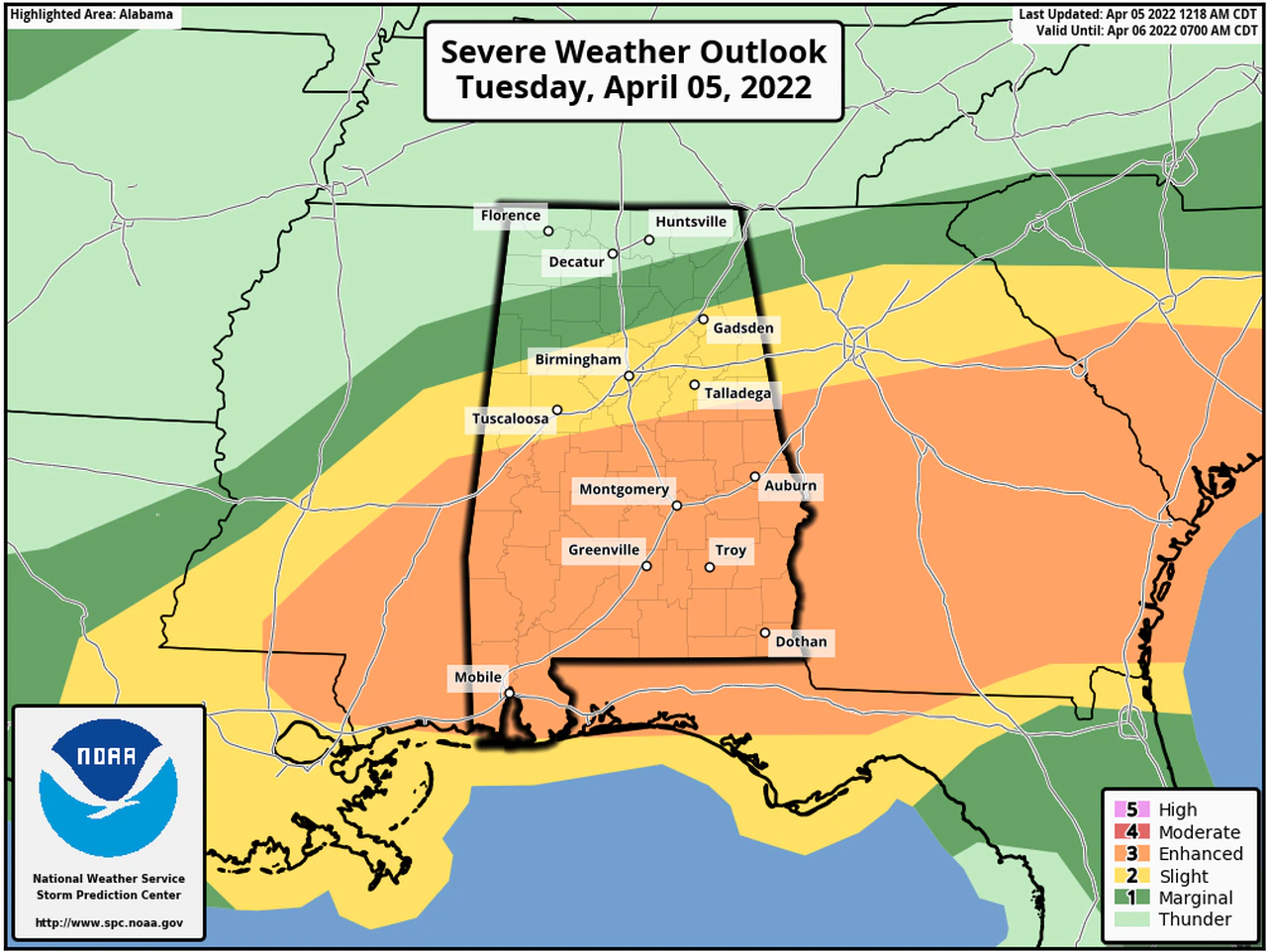
Severe weather will be possible across most of Alabama again today, starting up later this morning.
According to the National Weather Service – widespread rain and thunderstorms are expected to continue to spread across the state throughout the morning, as the warm front lifts across the region. The Storm Prediction Center has placed portions of both north, and central, Alabama in an Enhanced Risk category. An Enhanced Risk is Level 3 out of 5, and means that numerous severe storms will be possible; other areas in the state will have a Level 2/Slight, and Level 1/Marginal risk as well today.
Severe weather will also be possible Wednesday, as a cold front moves into the state.
Should it be deemed necessary – ALL Cherokee County Storm Shelters will be opened at the appropriate time and will remain open for the duration of the event:
- Centre Elementary School Storm Shelter
- The New Bethel Storm Shelter
- Sand Rock Storm Shelter
- The Cedar Bluff Community Center/Fire Department (SAFER PLACE)
- The Leesburg FEMA Building Storm Shelter
Make sure you have several ways to receive Weather Alerts. Download the FREE EMA mobile app, Sign up for Code Red Alerts. Text WEATHER1 to (256) 646-5300 to receive text alerts from WEIS Radio.
Calmer and cooler weather is expected starting on Thursday


You must be logged in to post a comment.