
This Hazardous Weather Outlook is for the counties served by the National Weather Service office in Birmingham.
Outlook through Tonight (Tuesday)
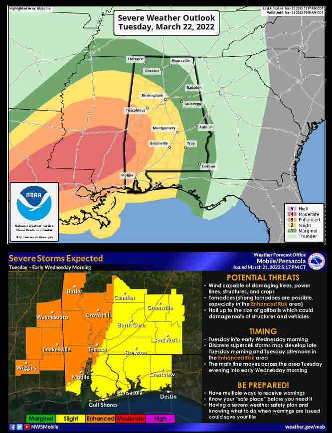
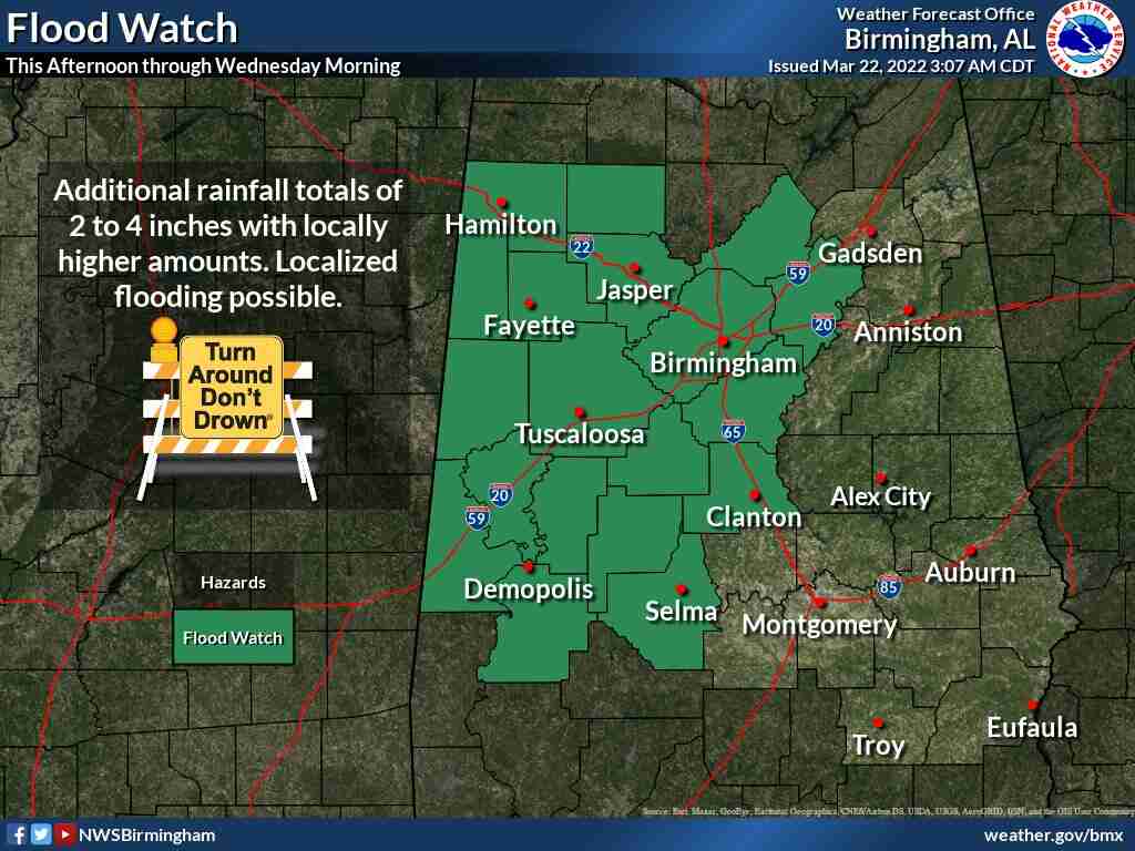
Strong to severe thunderstorms are possible this afternoon through tonight across Central Alabama. Threats include tornadoes, damaging wind gusts, and large hail. Locally heavy rainfall is likely this afternoon through tonight. One to three inches of rain is possible, with locally higher amounts. This could lead to flooding of low-lying or poor-drainage areas. Non-thunderstorm wind gusts up to 40 mph are possible across Central Alabama this afternoon through tonight. This could lead to sporadic tree fall and power outages.
Wednesday through next Monday.
River flooding now forecast for portions of the Tombigbee, and Black Warrior, Rivers – please refer to river products for specific information.
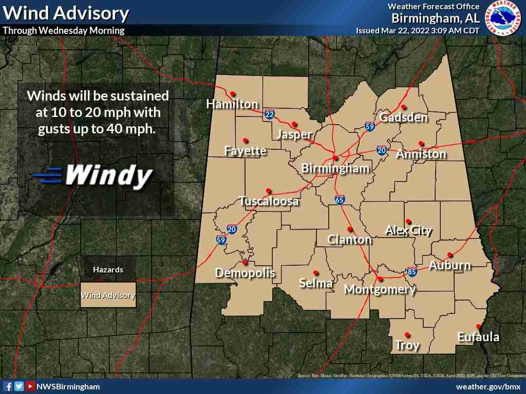
WIND ADVISORY IN EFFECT FROM 10:00am TUESDAY TO 7:00am WEDNESDAY
* WHAT
South winds 10 to 20 mph with gusts up to 40 mph expected.
* WHERE
Portions of central Alabama.
* WHEN
From 10:00am Tuesday to 7:00am Wednesday.
* IMPACTS
Gusty winds could blow around unsecured objects; tree limbs could be blown down and a few power outages may result.
PRECAUTIONARY/PREPAREDNESS ACTIONS
Use extra caution when driving – especially if operating a high profile vehicle. Secure outdoor objects.

Today
Mostly Sunny with isolated late-day showers possible / High of 78
Tonight
Showers and thunderstorms developing / Possibly severe at times w/wind gusts of up to 30 mph possible / Low around 60
Wednesday
Cloudy thru mid-morning with a 40% chance of thunderstorms / High of 74
Wednesday Night
Partly Cloudy / Low of 41
Thursday
Mostly Sunny / High of 64
EXTENDED FORECAST
Friday and Saturday
Mostly Sunny / High each day around 60


You must be logged in to post a comment.