
OVERVIEW:
A dynamic storm system will move across the area Friday and Friday night, this will result in a risk for strong to severe storms followed by a risk for lingering rain to transition to snow with some accumulations expected across north Central Alabama.
Windy conditions will develop outside any rain or thunderstorm activity and could lead to downed trees and powerlines. Cold weather will move in on Saturday, leading to the potential for freezing of moisture on sheltered roads and elevated surfaces. Temperatures Sunday morning will drop into the 20s for all of Central Alabama, which will lead to impacts for vulnerable populations and sensitive vegetation.
CHANGES FROM PREVIOUS FORECAST:
Removed risk of large hail. Minor adjustments made to the winter impact area.
WHERE:
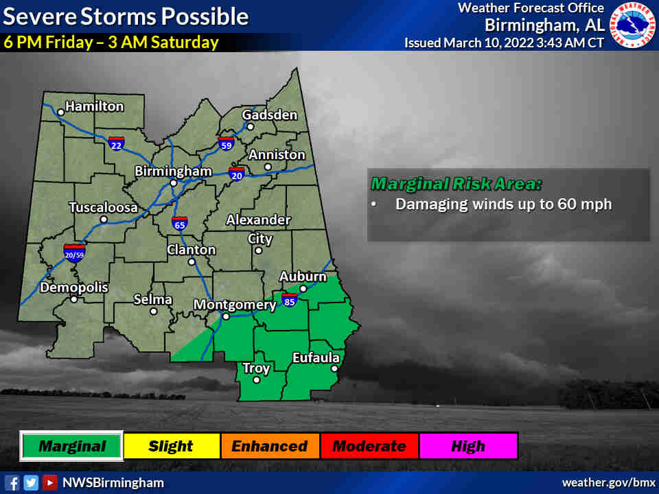
* Severe: Southeast Central Alabama (Along and south of Interstate 85)
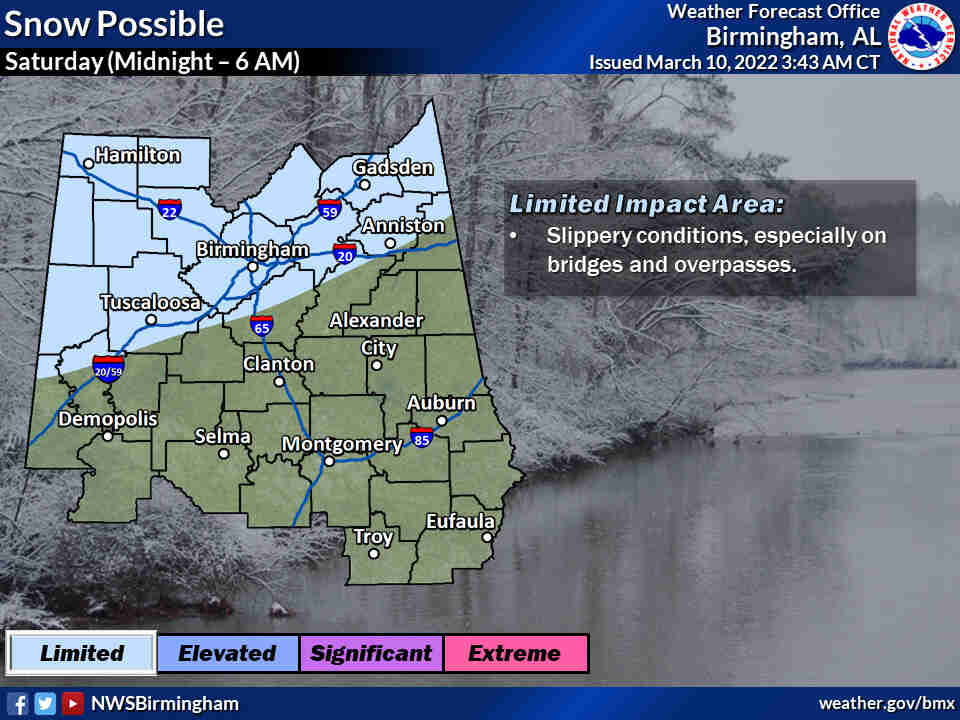
* Winter: Northern Central Alabama (Along and north of Interstate 20)
* Wind: All of Central Alabama
* Cold Weather: All of Central Alabama
WHEN:
* Severe: 6 pm Friday evening through 3 am Saturday morning
* Winter: Midnight Saturday morning through 6 am Saturday morning
* Wind: Midnight Saturday morning through Saturday evening
* Cold Weather: Saturday, Sunday, and Monday mornings
THREATS:
* Severe: Storms capable of producing damaging winds up to 60 mph
* Winter: Slippery conditions on elevated surfaces, minor accumulations up to an inch far north
* Wind: Sustained winds 15-20 mph with gusts up to 40 mph could lead to downed trees and power outages
* Cold Weather: Widespread freezing conditions could impact vulnerable populations and damage sensitive vegetation


You must be logged in to post a comment.