
Some Alabamians will get another chance to see snow this weekend after last week’s spring preview.
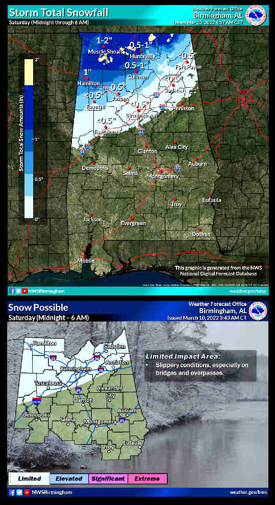
The National Weather Service says light snowfall will be possible in Alabama after a strong cold front moves through the state on Friday. The weather service said rain is expected to change over to snow after midnight on Friday – and possibly last through sunrise on Saturday. Forecasters said the snow could accumulate on grassy or elevated surfaces instead of pavement because of warmer ground temperatures.
However – it COULD cause a few slick spots on roads overnight Friday into Saturday, especially on elevated surfaces like bridges. Temperatures will take a dive starting Friday night, and very cold weather is expected through Sunday morning.
Temperatures will likely fall into the 20’s and 30’s, from Friday night into those early morning hours on Saturday, behind a cold front. On Saturday highs won’t change much, rising only into the mid-to-upper 30’s. Another chilly night will follow Saturday with most of the state expected to fall below freezing by Sunday morning. Temperatures are forecast to rebound on Sunday, with highs generally in the 50’s.


You must be logged in to post a comment.