

Wildfire Reported in Glencoe Area Burning at Etowah Calhoun County Line:
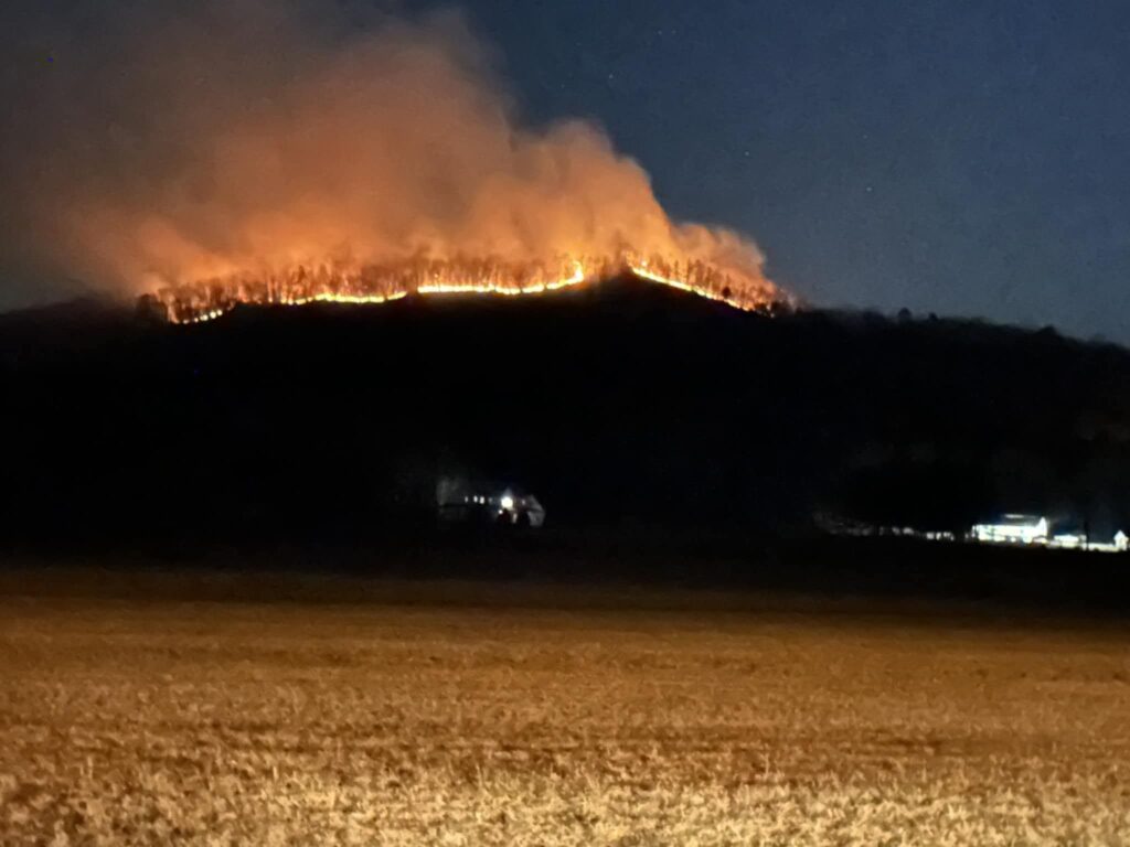
A Wildfire was reported on Monday in the Glencoe Area. The fire was in a hard to reach wooded area, South of Fords Valley Road., along the Etowah and Calhoun county line. The fire was visible from parts of Lookout mountain, Glencoe, and Hokes Bluff. Smoke from the fire had traveled as far as into Georiga.
Many at first though it may be part of a controlled, planned, prescribed burn that was announced farther to the South East earlier in the day. This fire was not related, and was classified as a wild fire by the Alabama Forestry Commission.
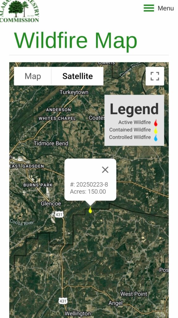
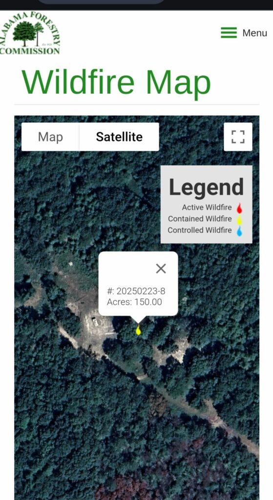
The area was not accessible to local fire departments, due to the terrain in which it occurred. The Alabama Forrestry Commission was called in to contain the blaze. They began cutting fire breaks using bulldozers, and as of around 5:15 PM, had the fire 75% contained. Contained is a term used to describe the percentage of the fire that is surrounded by a control line. It does not reference how much of the fire that has been extinguished. Around 8PM we received reports that those fighting the fire were working to gain better access to better fight the fire.
A local man who has property adjoining the fire, reported that as 1 AM, the fire was under control at that point. The last information showing from the Forrestry Commission showed the fire had burned around 150 Acres.
We have reached out to the Forestry Commission, and spoke with a dispatcher who directed us to their media department, and we will try and get an update as soon as they are in the office this morning. As of this reporting, there was no damage to any homes or structures in the area, or any injuries as a result of the fire. The cause usually takes a little longer to be determined. We will update this story if more information becomes available.
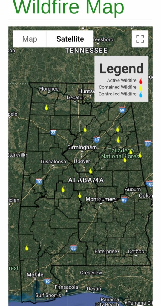
Below are photos of the fire, and maps of its location, which also show current fires across the state. You can access these maps at the Alabama Forestry Commission Website: https://www.forestry.alabama.gov/Pages/Maps/Wildfires.aspx at any time to see fires in progress.


You must be logged in to post a comment.