Flash Flood Watch Issued By The National Weather Service
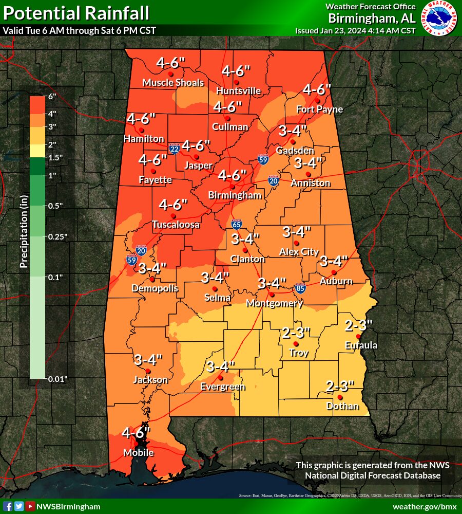
Waves of rain will propagate across Central Alabama beginning today and continuing through the end of the week. The most profound rainfall will occur during the period of Wednesday afternoon through Thursday evening when heavier rainfall will lead to a threat of flash flooding, mainly for areas north of I-85.
Where: The northern half of Central Alabama.
When: Wednesday afternoon through Thursday evening.
Threats: 2 to 4 inches of rainfall with locally higher amounts which could lead to flash flooding, especially in poor drainage and urban areas.


