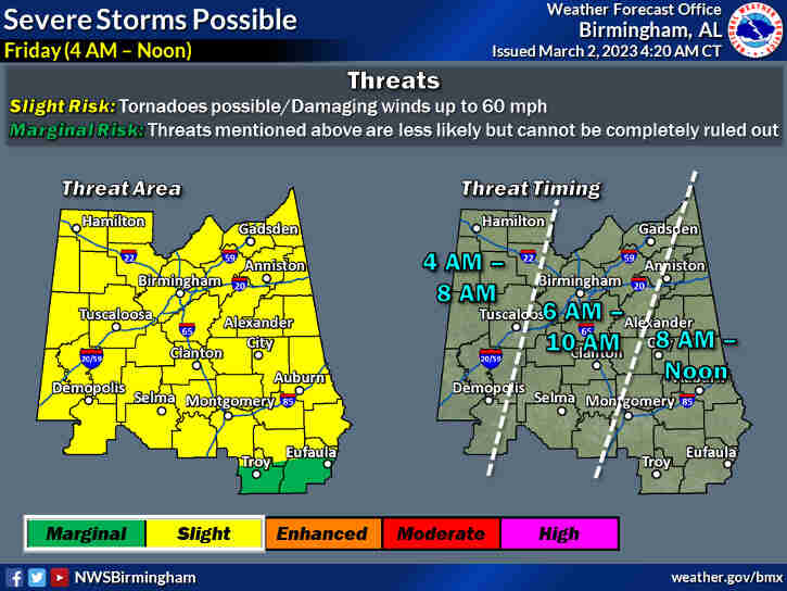
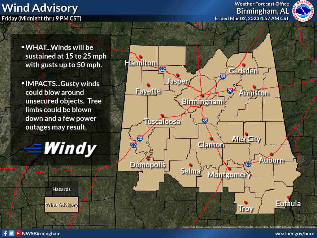
(530pm) Update from the NWS in Birmingham
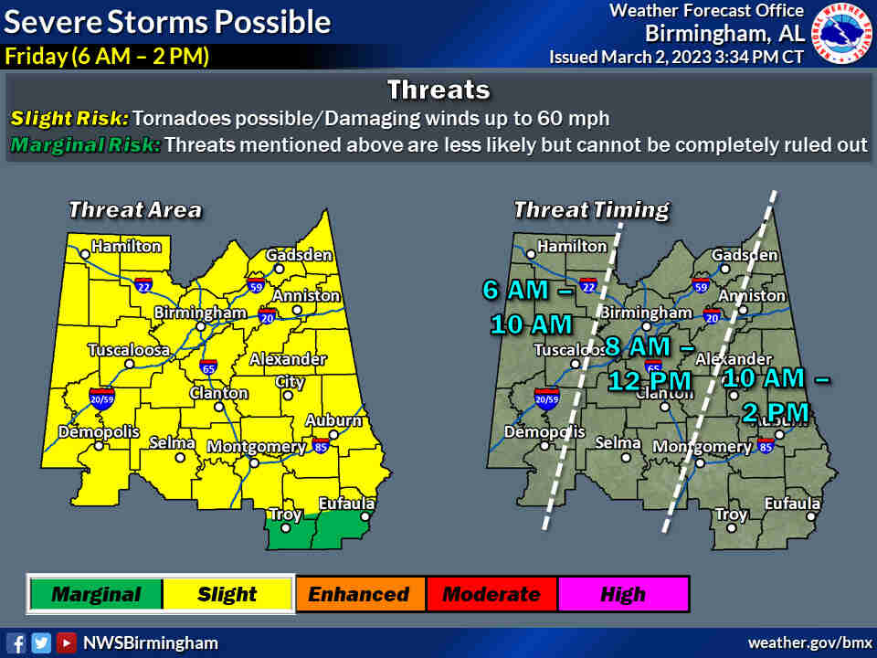
Overview: A broken line of showers and storms is expected to quickly
move across Central Alabama on Friday with a severe threat. Aside from
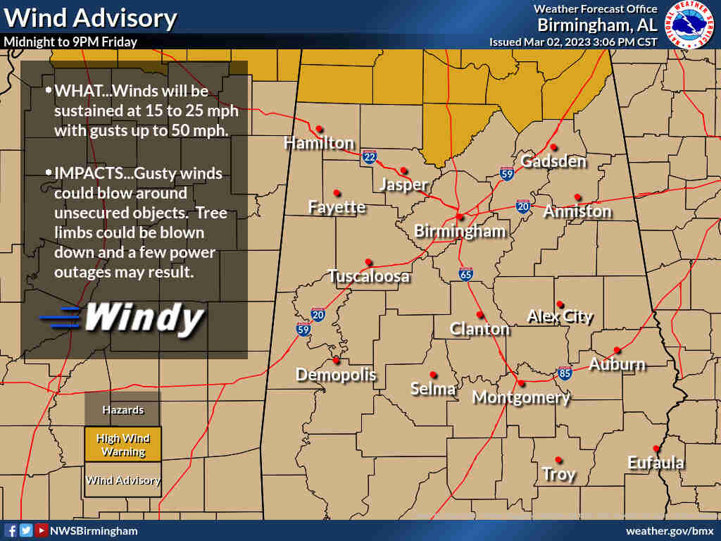
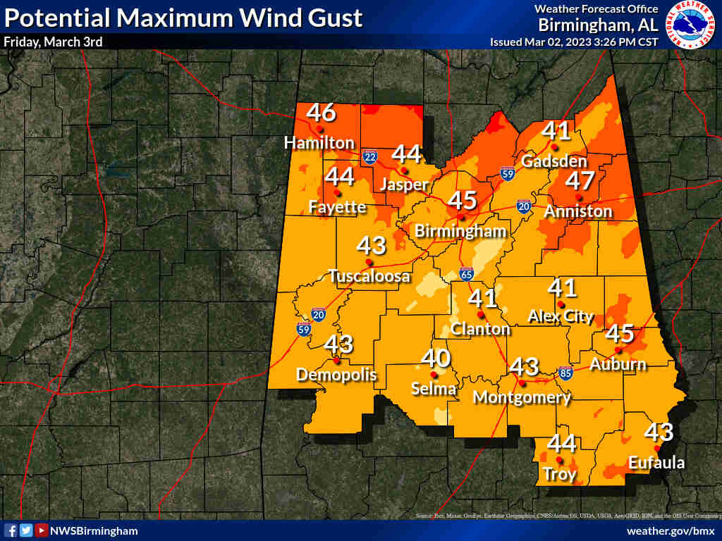
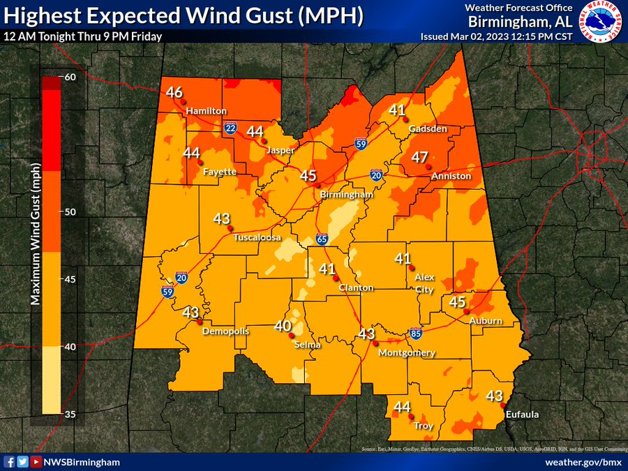
storms, it will be a windy day with gusts upwards of 50 mph with related
impacts.
Highlights:
Severe:
* Where: All of Central Alabama
* When: Friday 6 am to 2 pm
* Threats: Tornadoes and damaging winds up to 60 mph
Non-thunderstorm winds:
* Where: All of Central Alabama
* When: 12 am Friday to 9 pm Friday
* Threats: Downed trees/limbs and power outages due to gusts upwards
of 50 mph
(1230pm) From the National Weather Service in Birmingham’s Twitter feed:
Go ahead and close your patio umbrella and secure any other loose outdoor items because it will become very windy across the area tonight thru tomorrow! We may see non-tstorm wind gusts as high as 50 mph! This could lead to sporadic tree fall and intermittent power outages. #alwx
(10am) From the NWS earlier today
Overview:
A cold front will rapidly pass through the area tomorrow morning with a line of showers and thunderstorms. This system will produce a substantial increase in non-thunderstorm wind gusts in addition to a risk for severe storms.Changes from previous forecast:
Minor adjustments to the Slight risk area.Highlights: Where: * All of Central Alabama. When:
* Friday from 4 AM to Noon.
Threats:
* Tornadoes.
* Damaging winds up to 60 mph.


