
Very HOT temperatures and high humidity levels will enable strong to severe storms to develop this afternoon (Wednesday, June 15th). Some of the storms could become severe with damaging winds and hail. The storms are expected to be scattered and not everyone will get rain – according to the National Weather Service.
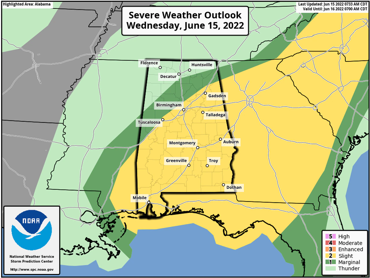
Strong to severe storms will be possible across a large part of the state and the Storm Prediction Center currently has most of the state in a Level 2 out of 5 risk for severe weather; the slight risk area as of Wednesday morning runs roughly along, and south of the Interstate 59 corridor. A narrow strip to the north and west of that has a Level 1 (or marginal) risk and could see isolated severe storms; only northwest Alabama is not included in a severe weather risk area today (Wednesday)
A Level 2 (or slight) risk means that scattered severe storms will be possible. A Level 1 risk means isolated severe storms will be possible; the strongest storms could have wind gusts up to 60 mph (which could take out trees and/or power lines), hail, heavy rain and lightning.
Storms will be most likely from about 2:00 until 10:00pm
Storms are expected to develop in Georgia, and track westward into Alabama – much like Tuesday.


You must be logged in to post a comment.