
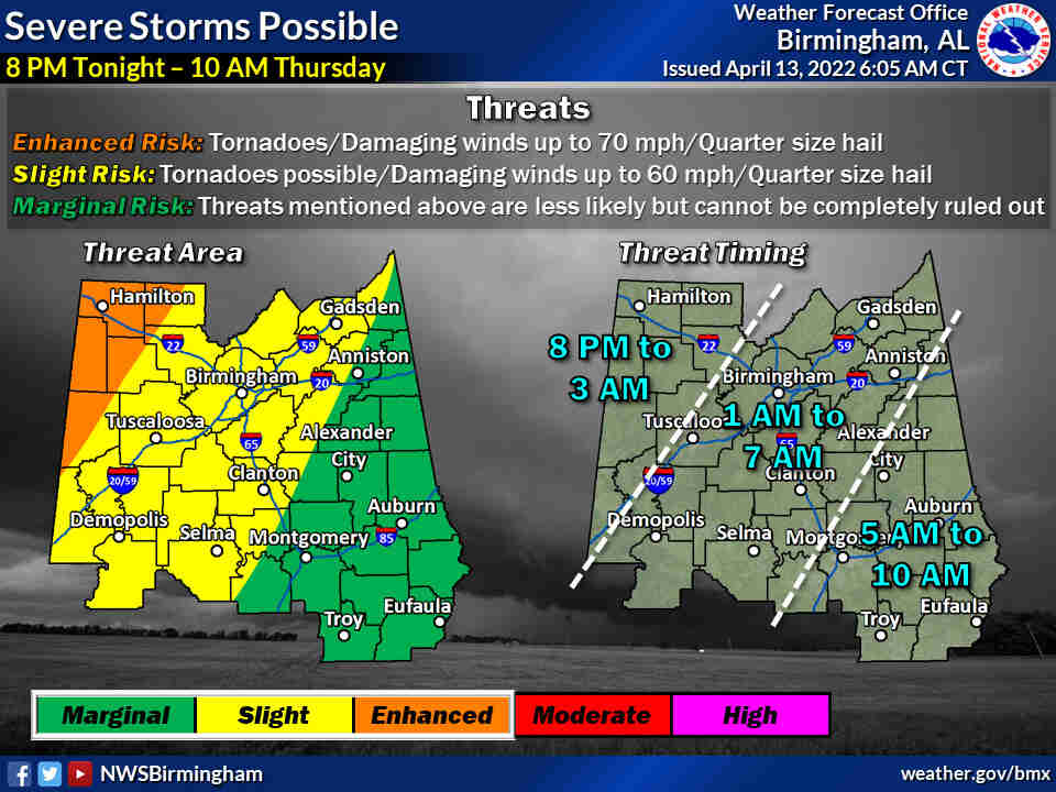
OVERVIEW:
Strong to severe storms are expected to move into Central Alabama tonight through Thursday morning. The best instability and shear to support severe storms will exist during the evening hours tonight across the far westernnorthwestern counties. The storms are expected to gradually weaken as they move east and southeast through early Thursday morning as severe ingredients lessen with time.
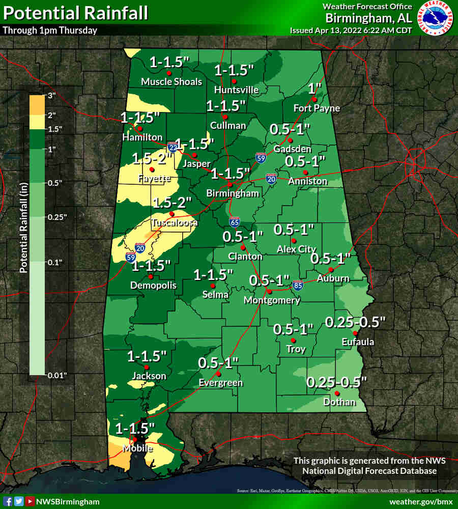
Heavy rains falling in a short period of time will also lead to localized flooding in low-lying or poor drainage areas, especially across the western half of Central Alabama.
CHANGES FROM PREVIOUS FORECAST:
The Enhanced Risk was expanded a little to the south and east. Localized flooding was added to the list of possible threats.
WHERE:
* All of Central Alabama
WHEN:
* Tonight (8PM) through Thursday (10 AM)
THREATS:
* Tornadoes
* Damaging winds up to 60 mph/70 mph winds in the “Enhanced Risk” area
* Quarter-size hail
* Localized Flooding in low-lying or poor drainage areas


You must be logged in to post a comment.