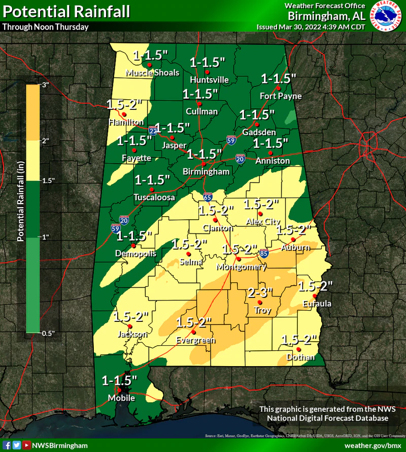
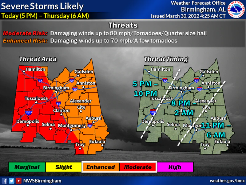
Alabama can expect another round of severe weather starting later today lasting into tomorrow morning (Wednesday into Thursday).
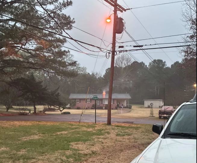
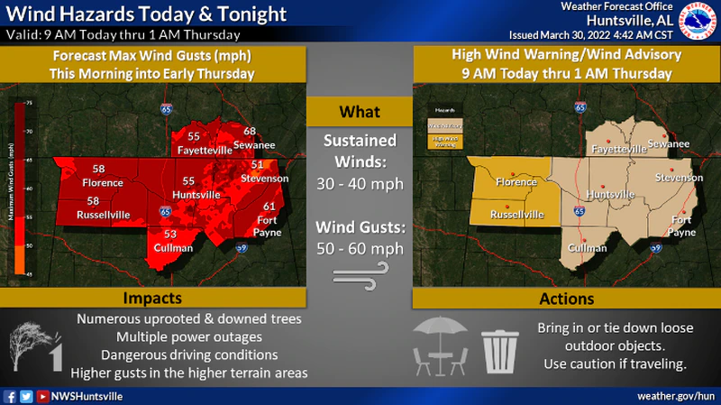
An intense line of storms is expected to form in Mississippi, and then move our way – arriving this afternoon with heavy rainfall, possibly hurricane-force wind, tornadoes and even hail. The National Weather Service is especially concerned about wind speeds, both today and tonight. Some areas could experience wind gusts in excess of 50 mph during the day – long before the storms arrive. Forecasters are warning that power outages will be possible from strong winds through tonight.
All of the state is under a wind advisory, and several counties in northwest Alabama have been put under a rarely-used high wind warning as the wind could gust up to 60 mph in those locations through early Thursday morning. The storms are expected to arrive later today (Wednesday) and could be intense and fast-moving. The Storm Prediction Center has nearly half of the state in a Level 4 out of 5 Moderate Risk for severe weather – which means widespread severe weather is likely.
The latest time-frame as predicted by the National Weather Service is as follows:
Strong storms will likely move into west Alabama – between 4:00 and 5:00pm today (Wednesday) and will the track eastward through the night into early Thursday.
Wind Advisory will be in effect now through 4:00am Thursday for Cherokee Etowah, Calhoun, Cleburne, Talladega, Clay, Randolph, Coosa, Tallapoosa, Chambers, Elmore, Montgomery, Macon, Bullock, Lee, Russell, Pike and Barbour counties.
High Wind Warning will be in effect until 1:00am Thursday for – Lauderdale, Colbert, Franklin and Lawrence counties.
Wind Advisory will be in effect for – Limestone, Madison, Morgan, Marshall, Jackson, DeKalb and Cullman counties from now until 1:00am Thursday.
A High Wind Warning in effect from 5:00 until 10:00pm for – Marion, Lamar, Fayette, Winston and Pickens counties.
Also a Wind advisory will be in effect through 1:00am Thursday for – Walker, Blount, Tuscaloosa, Jefferson, Shelby, St. Clair, Sumter, Greene, Hale, Perry, Bibb, Chilton, Marengo, Dallas, Autauga and Lowndes counties.
Calmer weather is expected after the storms move out on Thursday, and things could stay on the dry side until Saturday – when another weather system is set to arrive.

NOW is the time to prepare!
Make sure to have multiple ways to receive weather alerts! Text WEATHER1 to 256-646-5300 to receive FREE weather alerts from WEIS.
You can sign up for FREE Code Red alerts and download a free app from our partners at the Cherokee County Emergency Management Agency.
In the event that a Tornado Watch is issued for Cherokee County – the EMA office will coordinate the opening of storm shelters all across the county for the duration of the watch.
Those locations will include:
- The Centre Elementary School Storm Shelter
- The New Bethel Storm Shelter
- Sand Rock Storm Shelter
- The Cedar Bluff Community Center/Fire Department (SAFER PLACE)
- The Leesburg FEMA Building Storm Shelter
Stay tuned to WEIS Radio 990AM and 100.5 FM and all its social media outlets for the latest word on the weather situation,