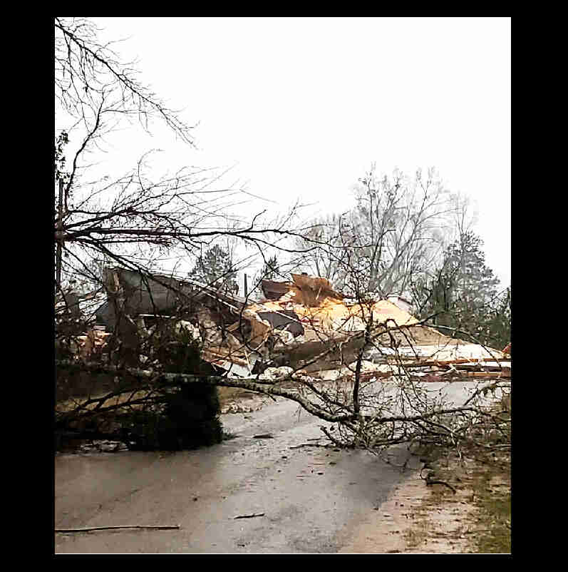
The National Weather Service issued a number of tornado warnings during those rounds of severe weather on Tuesday – at least three tornadoes have been confirmed thus far, as well as two instances of straight-line winds causing damage.
A survey team found damage consistent with an EF-0 tornado just northwest of Rogersville in Lauderdale County. The National Weather Service office in Mobile found EF-1 damage in Summerdale in Baldwin County and the Weather Service in Birmingham confirmed an EF-0 tornado tracked through Bibb and Shelby counties.
Another Huntsville crew determined damage in the Colbert Heights area of Colbert County, was caused by straight-line winds and not a tornado – and a survey team looking at damage in both Hale and Tuscaloosa counties also found it was from a severe thunderstorm and not a tornado.
Here’s a look at the tornadoes confirmed so far:
- Baldwin County (Summerdale to Robertsdale tornado), EF-1, max winds 90 mph. Path length 5.7 miles. Path width 40 yards. The tornado touched down at 11:07 p.m. Tuesday on County Road 34 South near a home in Summerdale and damaged a storage building. It likely reached peak intensity and damaged multiple trees before crossing Wynn Road, where it damaged a few irrigation systems. The tornado weakened as it headed north-northeast and caused minor damage to several homes before it reached Robertsdale. Once in Robertsdale the tornado caused EF-0-caliber damage, peeling roofing material off some small retail buildings. It headed into northeastern Robertsdale, taking down tree limbs and knocking over a shed. The tornado lifted in northeastern Robertsdale off Baldwin Street about 11:16 p.m. There were no injuries.
- Lauderdale County (Whitehead tornado), EF-0, max winds also estimated at 76 mph. It touched down at 5:29 p.m. Tuesday west of County Road 51 north of Mount Bethel Road and had a path length of 1.8 miles. It was 140 yards wide at its peak, according to the weather service. There were no injuries. The tornado toppled numerous trees, including one that fell on an abandoned building. A metal awning was also tossed about 50 yards away. The tornado crossed County Road 51 near County Road 543 and caused some damage to a house and a detached garage. Roof damage was also reported to outbuildings at Whitehead Baptist Church. The tornado headed northeast, where another home was damaged by a falling tree. The tornado lifted on County Road 89 about five minutes after touching down.
- Bibb and Shelby counties (Shades Creek tornado), EF-0, max winds estimated at 75 mph. Path length 2.79 miles. Path width 100 yards. This tornado touched down at 9:08 p.m. Tuesday and straddled the Bibb-Shelby county line, the weather service said, about halfway between Woodstock and Maylene. It first uprooted a few trees in northeast Bibb County, then headed northeast, downing a few more trees before lifting south of County Road 13 in southwest Shelby County. The track went through forested areas and no structural damage was reported.
The weather service issued a preliminary report on the Hale and Tuscaloosa storm, which caused damage south of Moundville, and estimated it had peak wind gusts of 76 mph.
Why not a tornado? The survey team said it appeared that very little debris was thrown into the air, and the damage path was consistently divergent “which are both indicative of straight-line winds.” In addition, there were two witnesses that saw the damaging winds and not a tornado. The damage was also nearly a mile south of where the circulation appeared on radar, the weather service said.
More details on the other storms will be released later, according to the weather service.
The weather service in Mobile also planned to survey more storm damage in Choctaw County.
The weather service in Birmingham also planned to survey damage in Greene County. The weather service also said that the NWS in Jackson, Miss., will take a look at Sumter County as it surveys damage on the other side of the state line in Mississippi.


