

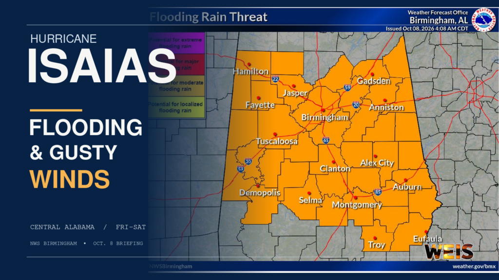
BIRMINGHAM– Heavy rain from Hurricane Isaias could cause flash flooding in Central Alabama from Friday into Saturday. The National Weather Service in Birmingham also warns of gusty winds, scattered power outages, and a possible isolated tornado threat.
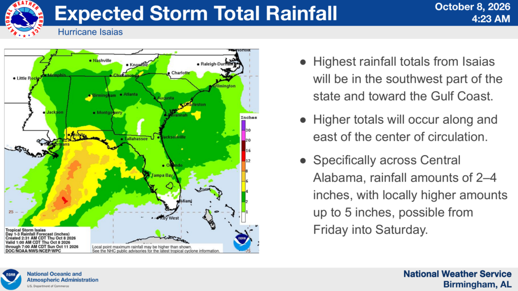
In a briefing issued at 4:23 a.m. Thursday, forecasters said the greatest confidence is in the rainfall threat. They also expect 2 to 4 inches across Central Alabama, with isolated totals as high as 5 inches. However, the heaviest rain is forecast farther southwest, toward the Gulf Coast.
The National Hurricane Center reported maximum sustained winds of 80 mph in Isaias at 4 a.m. Thursday. At that time, the Category 1 hurricane was over the southwestern Gulf and moving east-northeast. The forecast also calls for the storm to approach the northern Gulf Coast Friday into Saturday. Its track and the extent of local effects can still change.
Flooding Is the Primary Inland Concern
Heavy rain could quickly swell streams and overflow ditches and other low-lying areas. As a result, underpasses and roads that flood easily may become hazardous. The Birmingham office’s flooding graphic places a broad swath of Central Alabama, including the Gadsden and Anniston areas, in a zone of potential flooding rain.
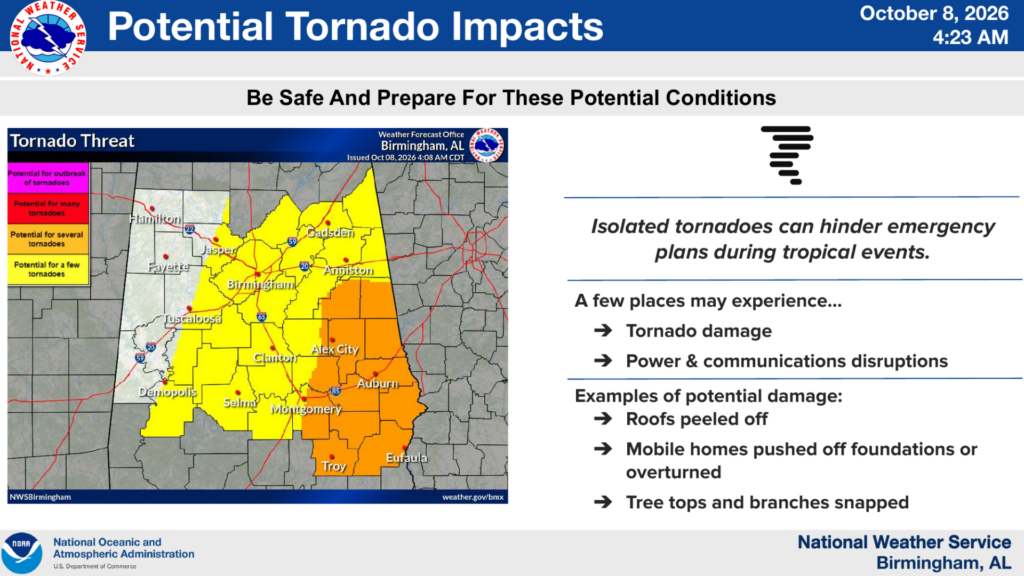
In addition, winds could bring down trees and cause scattered power and communications outages. Meanwhile, the Weather Service describes the tornado threat as isolated and less certain. The threat would favor areas east of the storm’s center track, so its placement will depend on how Isaias moves.
The office says tropical-storm-force winds could arrive in Central Alabama as early as Friday afternoon. If they reach the region, late Friday evening and overnight is the more likely arrival period. That timing does not mean every community will experience tropical-storm-force winds.
Prepare and Watch for Updates
Residents should consider preparations for flooding and possible outages. For example, keep phones charged, gather flashlights and necessary supplies, and make sure weather alerts can reach you overnight. Never drive through a flooded road.
The briefing is a snapshot of the forecast Thursday morning. The Birmingham office expects to update it at 11 a.m., and residents should check weather.gov/birmingham and local alerts for changing conditions.


You must be logged in to post a comment.