

UPDATED STORM RISK:
This story has been updated to reflect changes by the NWS in todays forecast.
CENTRAL ALABAMA– The severe weather threat has increased for parts of Central Alabama Thursday afternoon and evening.
An updated outlook from the National Weather Service in Birmingham places parts of the region under a Level 2 of 5, or slight, risk. The remainder of Central Alabama remains under a Level 1 of 5, or marginal, risk.
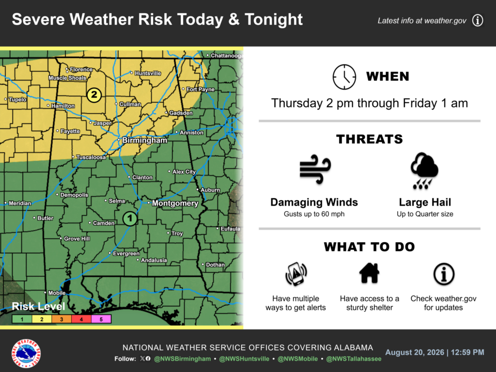
The threat will continue from 3 to 8 p.m. Thursday, Aug. 20. Damaging wind gusts up to 60 mph and large hail up to quarter size are the main concerns.
Residents should have multiple ways to receive weather warnings and access to sturdy shelter. They should continue monitoring conditions because stronger storms could develop quickly.
Another Severe Weather Risk Develops Friday
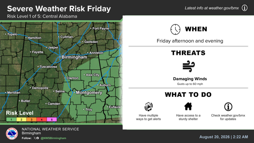
The storm threat will continue into Friday.
By Friday afternoon, the Level 1 risk will shift toward southeast portions of Central Alabama. The threat will continue into Friday evening.
Once again, isolated damaging winds will serve as the main concern. Gusts could reach 60 mph in stronger thunderstorms.
However, Friday’s risk area will cover a smaller portion of Central Alabama. Residents should check the latest forecast because the outlook may change.
Heat Advisory Continues Through Thursday Night
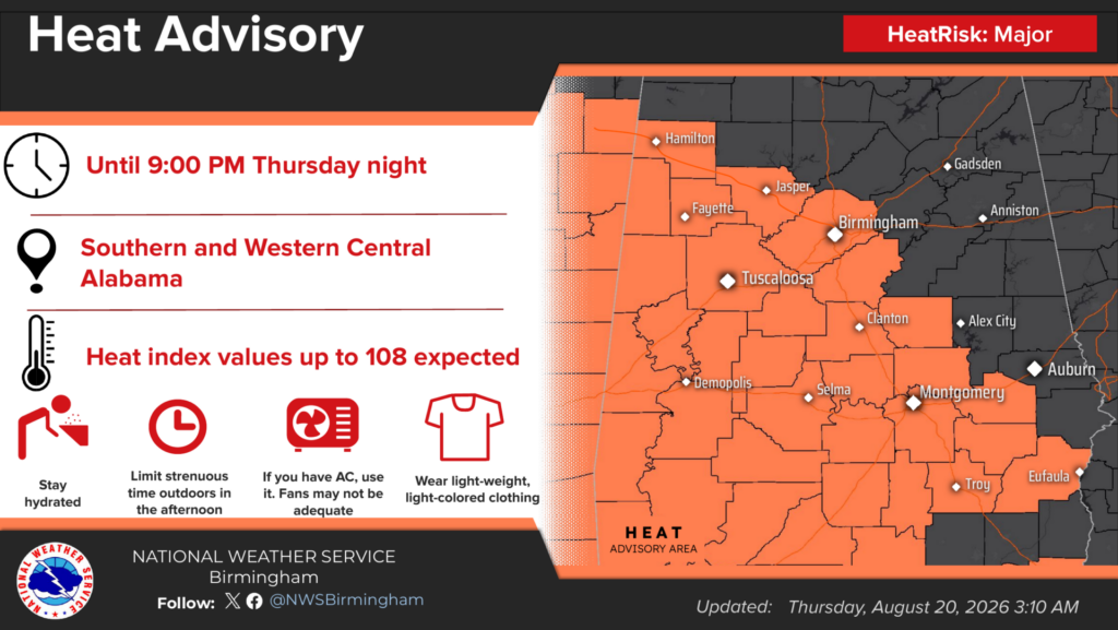
Meanwhile, dangerous heat will remain a concern across southern and western Central Alabama.
A Heat Advisory remains in effect through 9 p.m. Thursday. Heat index values could reach 108 degrees in the advisory area.
As a result, prolonged outdoor activity could increase the risk of heat-related illness. Children, older adults and people with health conditions may face greater risk.
The Weather Service recommends drinking plenty of water and limiting strenuous activity during the afternoon. People should also wear lightweight, light-colored clothing.
In addition, residents should use air conditioning when possible. Fans alone may not provide enough relief during dangerous heat.
Residents Encouraged to Monitor Weather Updates
Weather conditions can change quickly during the summer. Therefore, residents should monitor alerts before beginning outdoor activities or traveling.
The Weather Service recommends keeping a reliable warning source nearby. Residents should also avoid relying only on outdoor warning sirens.
People can follow official forecasts from NWS Birmingham. Local conditions and updates are also available through the WEIS Weather Center.
Editor’s note: This story was updated Thursday afternoon to reflect the upgraded Level 2 severe weather risk for parts of Central Alabama.



You must be logged in to post a comment.