

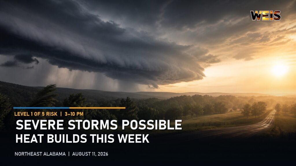
NORTHEAST ALABAMA — Strong thunderstorms could bring damaging winds to Northeast Alabama Tuesday afternoon before dangerous heat becomes the region’s primary weather concern later this week.
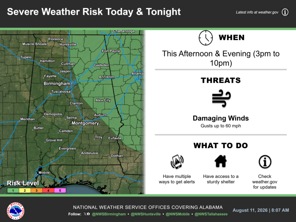
The National Weather Service in Birmingham has placed much of eastern and northern Alabama under a Level 1 severe weather risk. The threat will run from 3 until 10 p.m. Tuesday.
Damaging Winds Possible Tuesday
Forecasters say the strongest storms could produce wind gusts of up to 60 mph. The risk area includes communities around Fort Payne, Gadsden, Centre and Anniston.
Scattered storms will affect the region, so not every community will receive rain. However, residents should remain alert because stronger storms could develop quickly.
The National Weather Service recommends having several ways to receive warnings. Residents should also know where they will seek sturdy shelter if a warning is issued.
Storm Risk Continues Wednesday
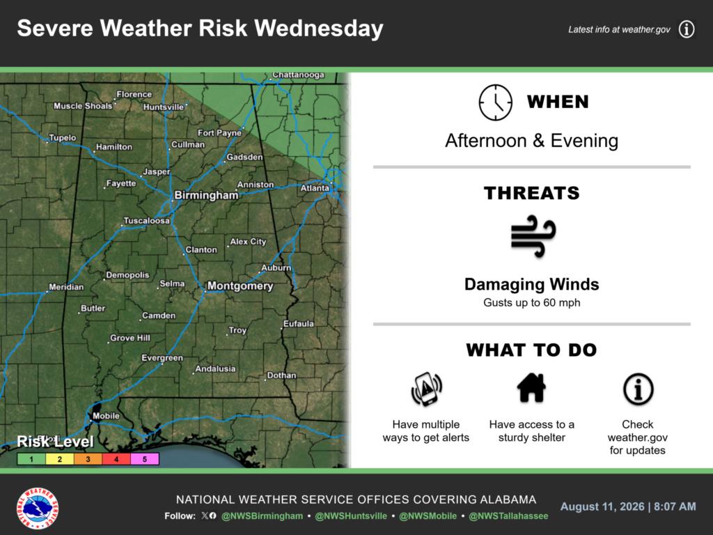
Scattered thunderstorms will remain possible Wednesday, especially across northeast Alabama. Portions of the region will remain under a Level 1 severe weather risk during the afternoon and evening.
Damaging wind gusts of up to 60 mph will remain the primary concern. Rain chances will generally range from 20% to 50%, depending on location.
Dangerous Heat Builds
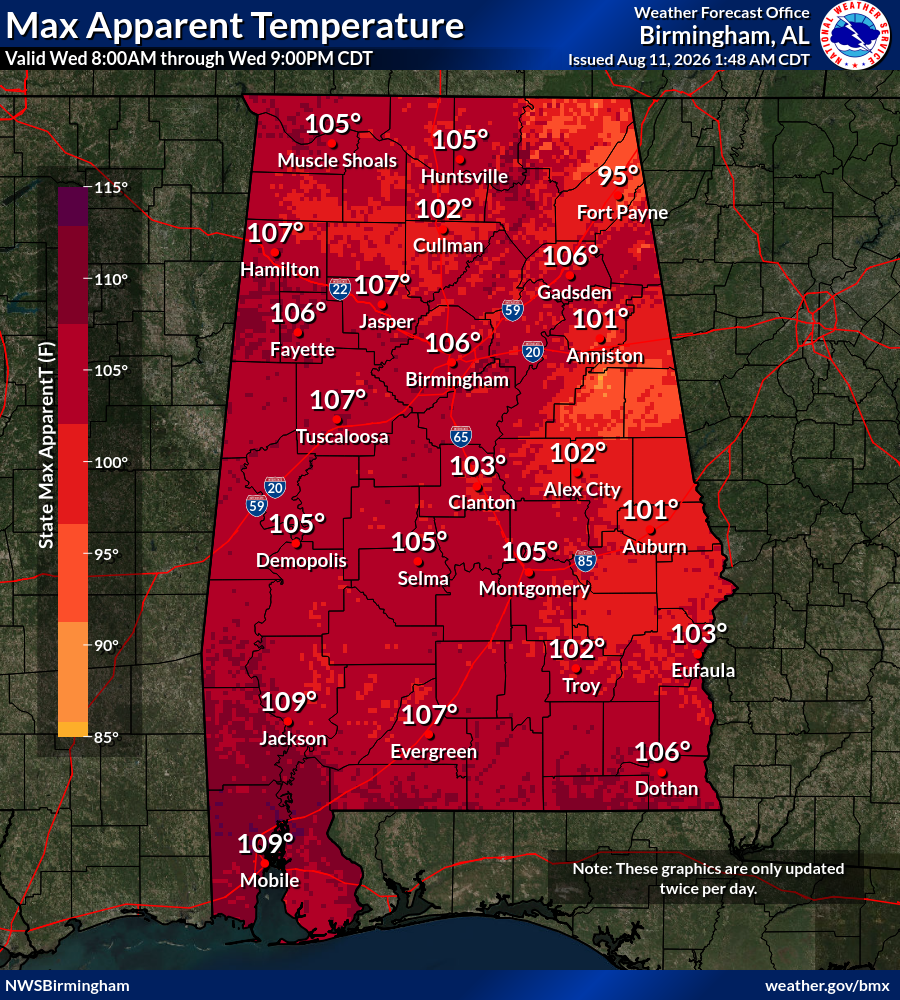
Heat will become a growing concern Wednesday. A Heat Advisory will be in effect from 1 until 9 p.m. for Cherokee, Etowah, Calhoun and several other Alabama counties.
The latest forecast graphic shows maximum apparent temperatures near 106 degrees in Gadsden, 101 in Anniston and 95 in Fort Payne on Wednesday.
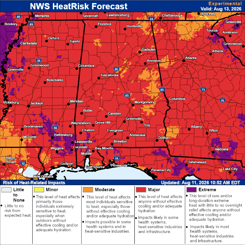
The National Weather Service expects a Major Heat Risk to develop across much of Alabama by Thursday. That level of heat can affect anyone without effective cooling or proper hydration.
Hotter and Drier Through the Weekend
According to the latest National Weather Service area forecast discussion, a strengthening ridge of high pressure will reduce rain chances after Wednesday.
High temperatures will climb into the middle and upper 90s across much of Central and Northeast Alabama later this week. Heat index readings could reach 105 to 110 degrees each day from Wednesday through the weekend.
Temperatures could run about 10 degrees above normal by the weekend. Forecast guidance indicates the hot pattern may continue into early next week.
Residents should limit strenuous outdoor activity during the hottest part of the day. Drink plenty of water, take frequent breaks and check on relatives and neighbors. Children and pets should never be left inside a parked vehicle.
Anyone overcome by heat should move to a cool location. Heat stroke is a medical emergency, and residents should call 911 immediately if it is suspected.



You must be logged in to post a comment.