
The National Weather Service is forecasting a stretch of hot, humid, and unsettled weather across the Tennessee Valley this week, with multiple hazards expected to impact the region.
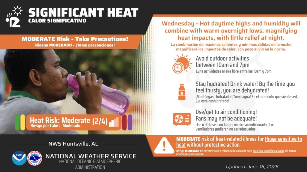
Forecasters say dangerous heat will be a primary concern, with heat index values expected to approach 100 degrees on Tuesday. Residents are being urged to use caution, limit time outdoors during peak afternoon hours, stay hydrated, and take frequent breaks in air-conditioned spaces.
In addition to the heat, the region also faces the threat of heavy rainfall and possible flash flooding as a series of weather systems move through the area. Forecasters note that repeated rounds of showers and thunderstorms could lead to localized flooding in low-lying and poor drainage areas.
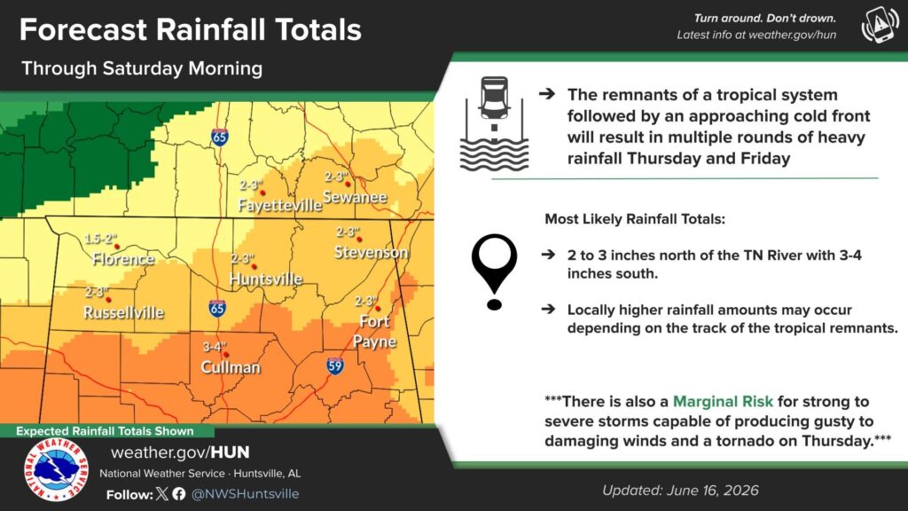
A low-end risk for strong to severe thunderstorms is also in place, with the potential for isolated damaging wind gusts in stronger storms.
The National Weather Service encourages residents to stay weather-aware throughout the week and monitor updated forecasts as conditions develop.


You must be logged in to post a comment.