
From the National Weather Service in Birmingham:
Fire Weather Watch
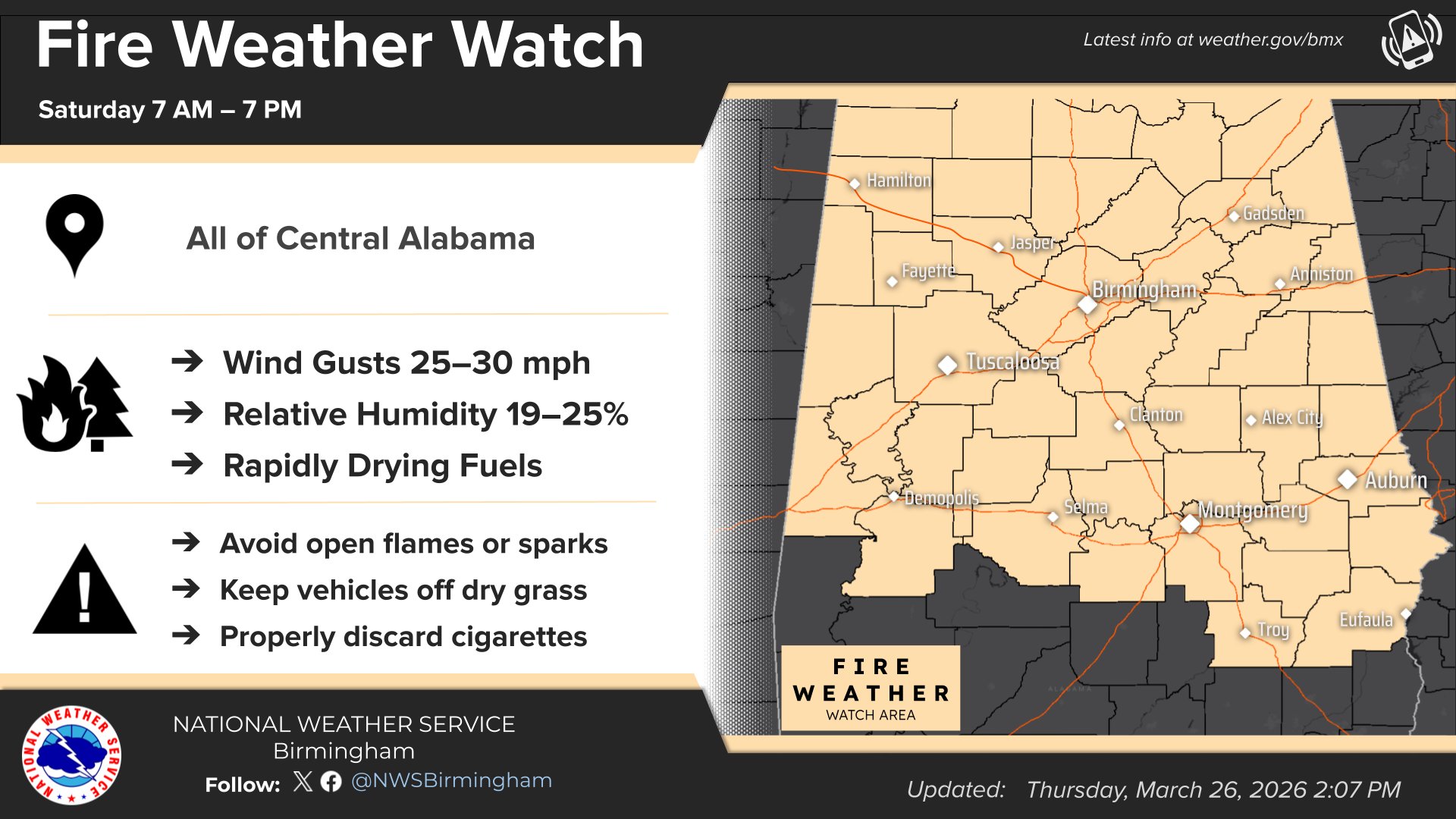
URGENT – FIRE WEATHER MESSAGE
National Weather Service Birmingham AL
1026 PM CDT Thu Mar 26 2026
…ENHANCED FIRE DANGER EXPECTED ON SATURDAY…
Marion-Lamar-Fayette-Walker-Blount-Etowah-Calhoun-Cherokee-Cleburne-Pickens-Tuscaloosa-Jefferson-Shelby-St. Clair-Talladega-Clay-Randolph-Sumter-Greene-Hale-Perry-Bibb-Chilton-Coosa-Tallapoosa-Chambers-Marengo-Dallas-Autauga-Lowndes-Elmore-Montgomery-Macon-Bullock-Lee-Russell-Pike-Barbour-
…FIRE WEATHER WATCH REMAINS IN EFFECT FROM SATURDAY MORNING THROUGH SATURDAY EVENING FOR CENTRAL ALABAMA…
* WINDS…North-northeast 10 to 15 mph with gusts up to 30 mph.
* RELATIVE HUMIDITY…As low as 20 percent.
* IMPACTS…The combination of a dry air mass and windy conditions will result in critical fire weather conditions. Outdoor burning is not recommended.
PRECAUTIONARY/PREPAREDNESS ACTIONS…
A Fire Weather Watch means that critical fire weather conditions are forecast to occur. Listen for later forecasts and possible Red Flag Warnings.
From the National Weather Service in Huntsville:
Fire Weather Watch
URGENT – FIRE WEATHER MESSAGE
National Weather Service Huntsville AL
1032 PM CDT Thu Mar 26 2026
…Fire Weather Watch in Effect Saturday 7 AM until 7 PM For All of North Alabama…
Lauderdale-Colbert-Franklin AL-Lawrence-Limestone-Madison-Morgan-Marshall-Jackson-DeKalb-Winston-Cullman-
…FIRE WEATHER WATCH REMAINS IN EFFECT FROM SATURDAY MORNING THROUGH SATURDAY EVENING FOR ALL OF NORTH ALABAMA FOR ELEVATED WINDS AND DRY CONDITIONS…
* AFFECTED AREA…Fire Weather Zone 001 Lauderdale, Fire Weather Zone 002 Colbert, Fire Weather Zone 003 Franklin AL, Fire Weather Zone 004 Lawrence, Fire Weather Zone 005 Limestone, Fire Weather Zone 006 Madison, Fire Weather Zone 007 Morgan, Fire Weather Zone 008 Marshall, Fire Weather Zone 009 Jackson, Fire Weather Zone 010 DeKalb, Fire Weather Zone 014 Winston and Fire Weather Zone 016 Cullman.
* WINDS…Northeast 15-20 mph with gusts up to 30-35 mph.
* RELATIVE HUMIDITY…As low as 20 percent.
* IMPACTS…Any fires that develop will likely spread rapidly. Please obey any local burn bans that are in place!
PRECAUTIONARY/PREPAREDNESS ACTIONS…
A Fire Weather Watch means that critical fire weather conditions are forecast to occur. Listen for later forecasts and possible Red Flag Warnings.
Stay with WEIS 100.5 FM, 990 AM, & the WEIS Radio app for the latest weather updates.


You must be logged in to post a comment.