
A blast of cold air — the coldest so far this season — is headed for Alabama this weekend.
The National Weather Service says temperatures will drop sharply once a strong cold front moves through Saturday night, especially in north Alabama. There is a small chance of a wintry mix in the north late Saturday night, but forecasters say those chances continue to shrink.
The Weather Service in Huntsville says there’s a 20 to 30 percent chance of drizzle or very light rain that could briefly change to sleet or tiny ice pellets before ending early Sunday morning. Any ice accumulation is expected to be only a trace, if it happens at all.
Most of the state will just see light rain, but the big story will be the cold. High temperatures on Sunday will fall through the day, with a stiff north wind making it feel even colder.
North Alabama will see highs only in the low 30s. Central Alabama will range from the mid-30s in the north to the low 50s farther south. South Alabama stays warmer a little longer, with highs in the 50s and low 60s near the coast.
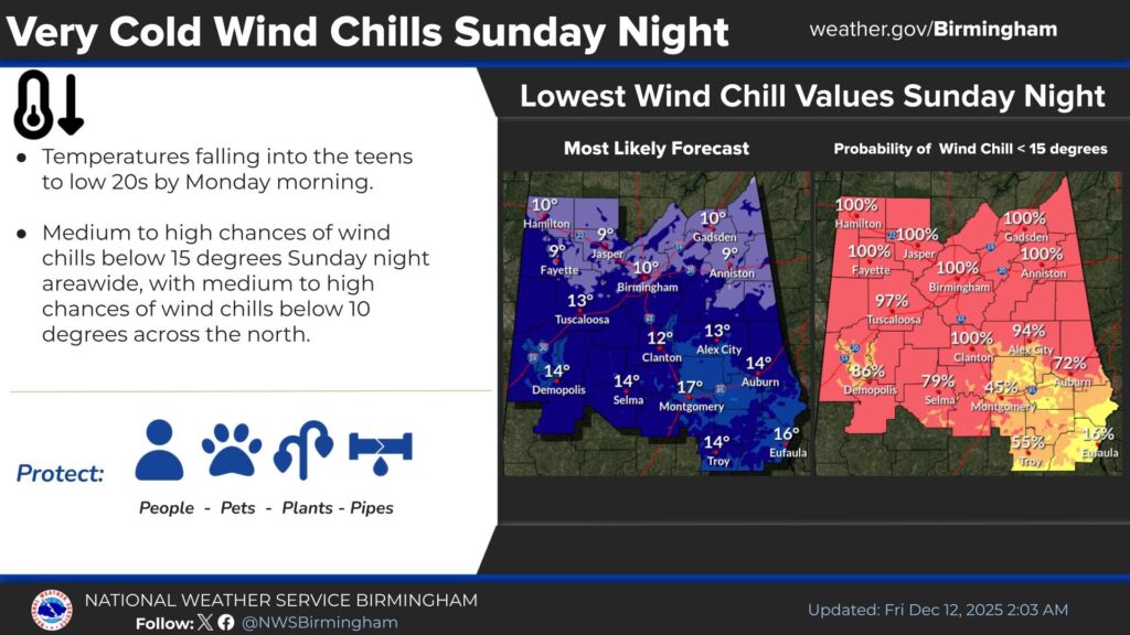
With temperatures this cold, officials are reminding everyone to protect people, pets, plants, and pipes.
The good news: this cold snap won’t last long. Temperatures are expected to start warming back up on Tuesday.


You must be logged in to post a comment.