
Flood Watch
National Weather Service Birmingham AL
1246 AM CDT Mon Aug 4 2025
…FLOOD WATCH NOW IN EFFECT THROUGH TUESDAY EVENING…
* WHAT…Flooding caused by excessive rainfall continues to be possible.
* WHERE…A portion of central Alabama, including the following counties, Barbour, Bullock, Calhoun, Chambers, Cherokee, Clay, Cleburne, Coosa, Elmore, Lee, Macon, Montgomery, Pike, Randolph, Russell, Talladega and Tallapoosa.
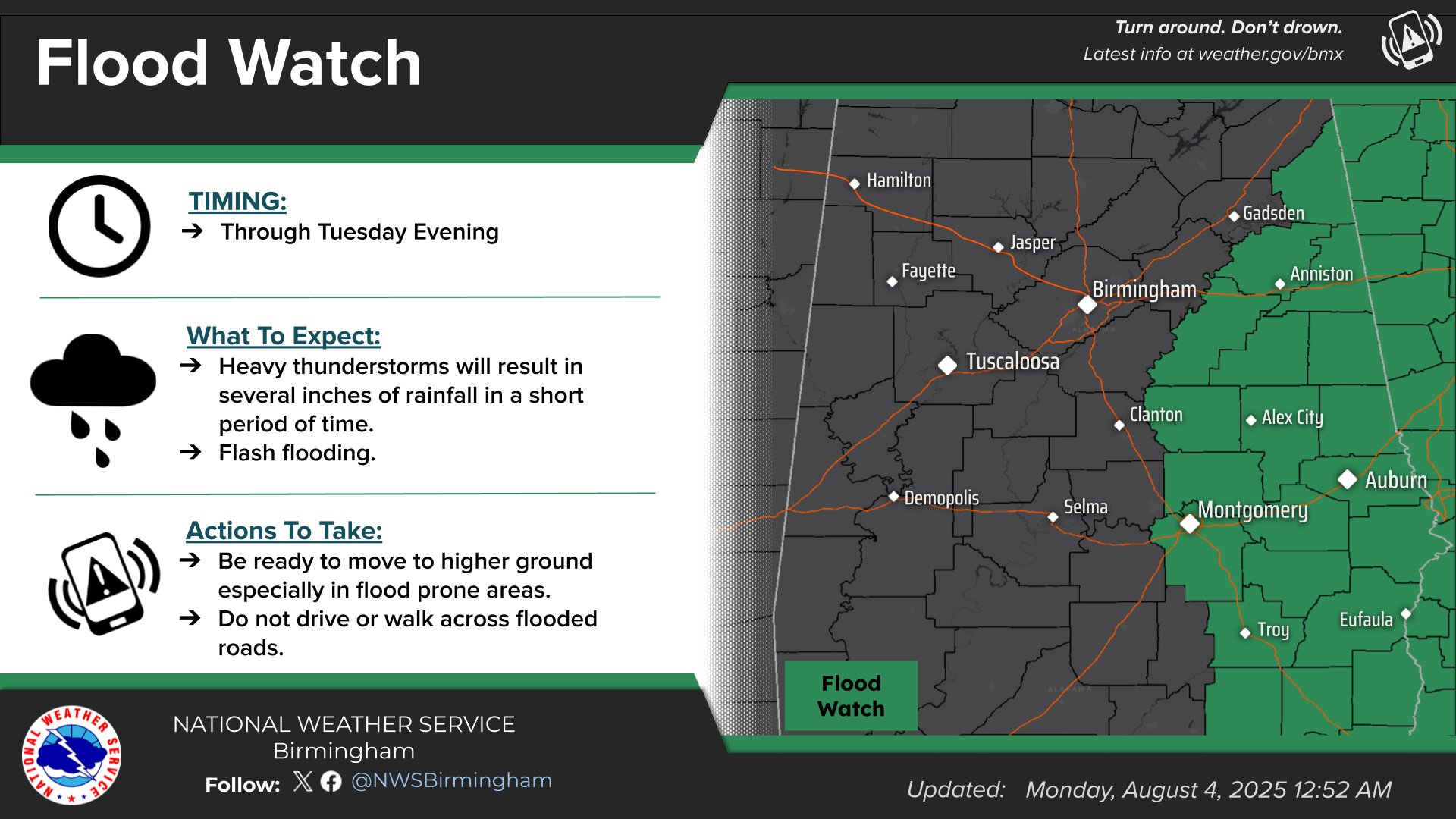
* WHEN…Through Tuesday evening.
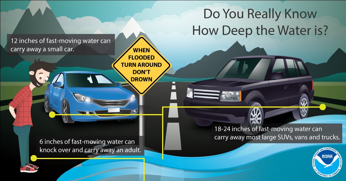
* IMPACTS…Excessive runoff may result in flooding of rivers, creeks, streams, and other low-lying and flood-prone locations. Creeks and streams may rise out of their banks. Extensive street flooding and flooding of creeks and rivers are possible.
* ADDITIONAL DETAILS…
– There is a risk for showers and thunderstorms with heavy rain across the watch area. Due to the potential for slow-moving and training activity, as well as high rain rates, flash flooding could occur.
– http://www.weather.gov/safety/flood
PRECAUTIONARY/PREPAREDNESS ACTIONS…
You should monitor later forecasts and be alert for possible Flood Warnings. Those living in areas prone to flooding should be prepared to take action should flooding develop.
Stay with WEIS 100.5 FM, 990 AM, and the WEIS Radio app for the latest weather updates.


You must be logged in to post a comment.