

Flood Watch
National Weather Service Birmingham AL
913 AM CDT Tue May 27 2025
…FLOOD WATCH IN EFFECT THROUGH LATE TONIGHT…
* WHAT…Flooding caused by continued rounds of showers and thunderstorms with heavy rainfall.
* WHERE…A portion of central Alabama, including the following counties, Autauga, Barbour, Bibb, Bullock, Calhoun, Chambers, Chilton, Clay, Cleburne, Coosa, Dallas, Elmore, Greene, Hale, Jefferson, Lee, Lowndes, Macon, Marengo, Montgomery, Perry, Pickens, Pike, Randolph, Russell, Shelby, St. Clair, Sumter, Talladega, Tallapoosa and Tuscaloosa.
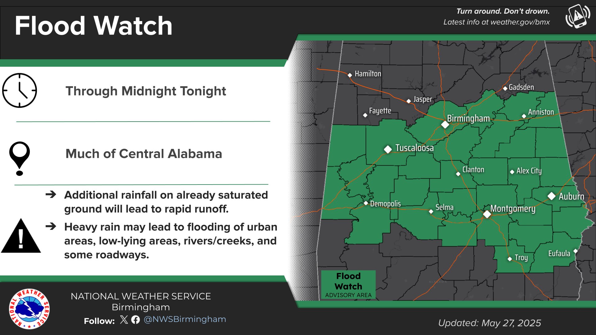
* WHEN…Through late tonight.
* IMPACTS…Excessive runoff may result in flooding of rivers, creeks, streams, and other low-lying and flood-prone locations. Urban areas will be most susceptible to flooding through the overnight hours.
* ADDITIONAL DETAILS…
– Saturated soil conditions are present following multiple rounds of heavy rainfall over the past 48 hours. Rapid runoff is expected with widespread heavy rainfall that will move across Central Alabama through late tonight.
– http://www.weather.gov/safety/flood
PRECAUTIONARY/PREPAREDNESS ACTIONS…
You should monitor later forecasts and be alert for possible Flood Warnings. Those living in areas prone to flooding should be prepared to take action should flooding develop.

Stay with WEIS 100.5 FM, 990 AM, and the WEIS Radio app for the latest weather updates.


You must be logged in to post a comment.