
Severe Weather Risk Levels Tuesday Through Thursday
From the National Weather Service in Birmingham:
The period of stormy weather will continue through the next few days as
waves of strong thunderstorms move across the area. Some storms may
become severe.
FORECAST CHANGES:
*
Adjusted the threat timing for today and made minor adjustments to the
threat areas. Introduced Marginal risk of severe storms for Thursday
HIGHLIGHTS:
*
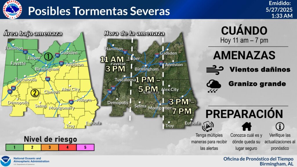
Today
* Where: All of Central Alabama
* When: Late this morning through the afternoon (11 AM – 7 PM)
* Threats: Damaging wind gusts up to 60 mph and large hail up to
quarter size.
*
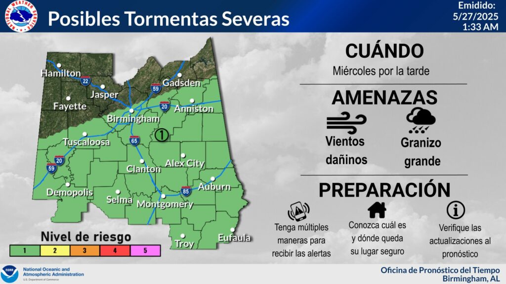
Wednesday
* Where: Generally along and south of the I-20 corridor.
* When: Wednesday afternoon
* Threats: Damaging wind gusts up to 60 mph and large hail up to
quarter size.
*
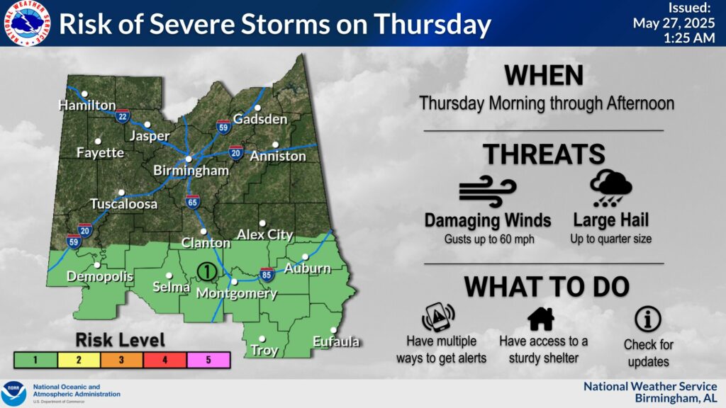
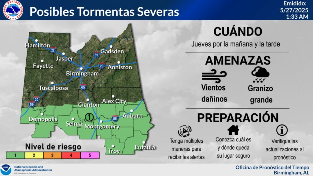
Thursday
* Where: Generally along and south of US Hwy 80.
* When: Late Thursday morning through the afternoon.
* Threats: Damaging wind gusts up to 60 mph and large hail up to
quarter size.
The National Weather Service in Birmingham:


You must be logged in to post a comment.