Marginal Severe Weather Risk Forecast for Central Alabama This Weekend
Here’s your latest weather update from the National Weather Service in Birmingham.
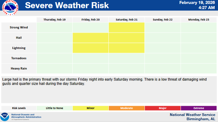
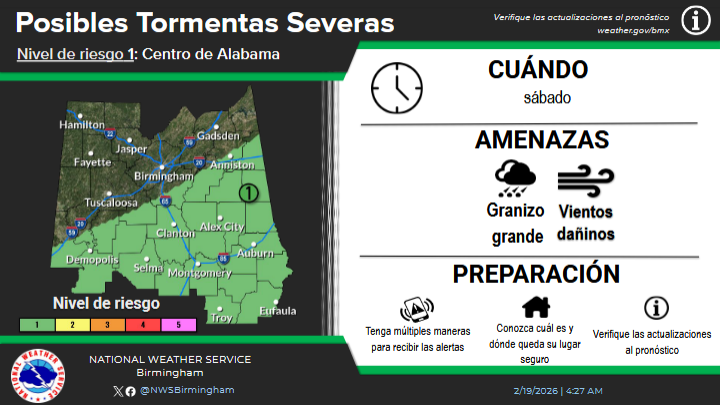
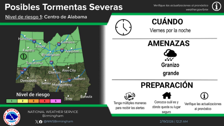
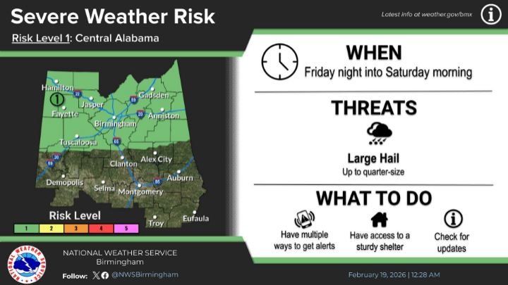
Forecasters say a low, Level 1 out of 5 marginal risk for severe thunderstorms has been introduced for much of Central Alabama from Friday night through Saturday evening.
A warm front moving through the region Friday night into early Saturday morning could bring a severe storm or two to northern portions of Central Alabama, with large hail listed as the primary threat.
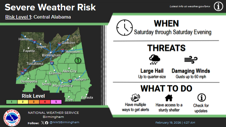
The risk then shifts to the southeastern half of Central Alabama Saturday through Saturday evening as a cold front moves across the state. During that time, a few storms could produce hail up to quarter size along with damaging wind gusts up to 60 miles per hour.
While the overall severe weather threat remains low, widespread rain is expected across the area, with rainfall totals between one-half and three-quarters of an inch forecast from Friday through Saturday.