Updated Forecast Refines Winter Weather Threat for Cherokee and Etowah Counties

The National Weather Service in Birmingham has refined its forecast for a potential winter weather event expected to impact portions of Central Alabama this weekend, with updated guidance clarifying the timing, precipitation types, and areas of greatest concern for northeastern counties, including Cherokee and Etowah.
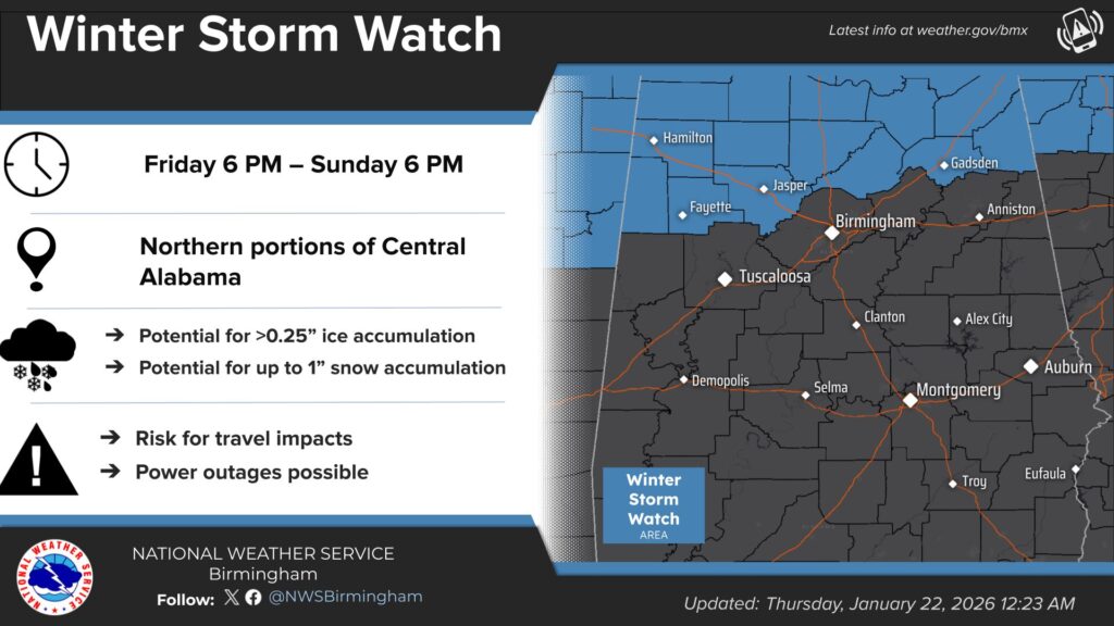
A Winter Storm Watch remains in effect for northern Central Alabama from 6 p.m. Friday through 6 p.m. Sunday, as forecasters continue to monitor a developing system that could bring a mix of cold rain, freezing rain, sleet, and snow to the region.
According to the latest forecast update, weather models have come into better agreement on the track of a surface low pressure system, now expected to pass near or just south of Birmingham early Sunday morning. This change is significant, as it influences both temperature trends and the type of precipitation expected across the state.
Warmer air moving into Central Alabama ahead of the system is now forecast to keep temperatures above freezing in many areas Saturday night. However, Cherokee and Etowah counties remain at risk for freezing rain, particularly Saturday evening into early Sunday morning, before temperatures rise above freezing.
The National Weather Service says freezing rain with potential ice accumulation is possible across northeastern Alabama, including Cherokee County, Etowah County, northeast Calhoun County, and northern Cleburne County. While the heaviest ice accumulation is currently forecast farther west, even light icing in these counties could create hazardous travel conditions and lead to isolated power disruptions.
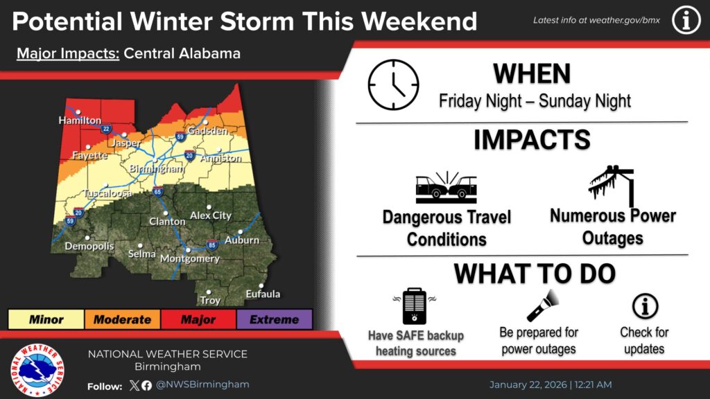
Forecasters are also monitoring a rapid temperature drop expected Sunday afternoon and evening as the surface low moves east into Georgia. As colder air returns to the region, additional ice or light snow accumulation may occur Sunday night, especially if lingering moisture remains in place.
Only minimal changes were made to the National Weather Service impact graphics, and no changes are needed at this time to the Winter Storm Watch, reflecting continued uncertainty regarding the extent of impacts.
WEIS will receive its next weather briefing from the National Weather Service at 10 a.m. Following that briefing, updated information will be provided as it becomes available. Residents are encouraged to continue to stay tuned to WEIS and visit weisradio.com for the most up-to-date weather information as the forecast continues to change.
https://weisradio.com/2026/01/21/alabama-power-activates-storm-plan-ahead-of-winter-weather/
https://weisradio.com/2026/01/21/a-message-from-sheriff-jeff-shaver-2/
https://weisradio.com/2026/01/22/aldot-actively-preparing-for-potential-winter-weather/