A Winter Storm Watch remains in effect from Friday evening through Sunday afternoon for much of north and central Alabama.
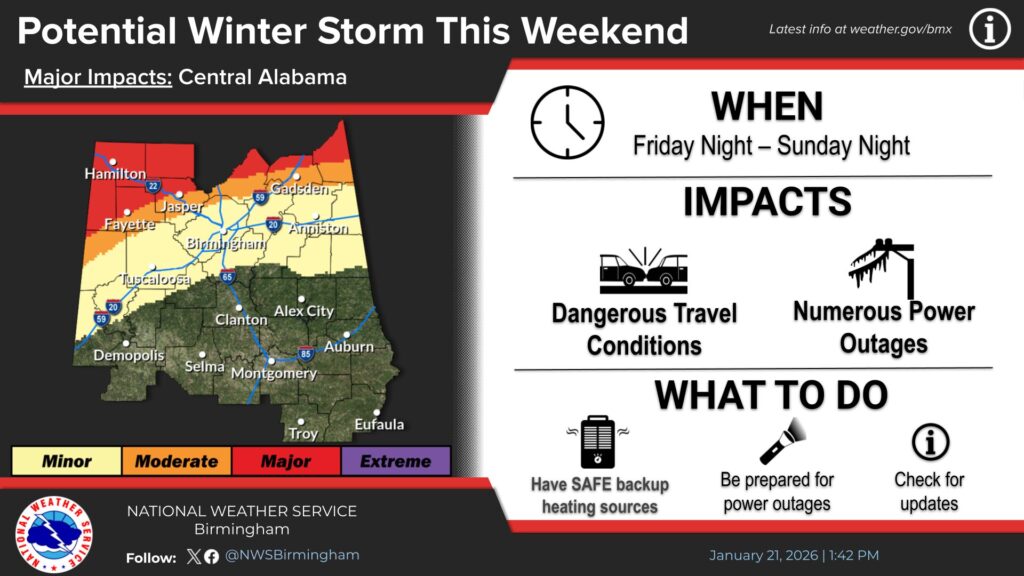
Heavy mixed precipitation is possible, including freezing rain, with ice accumulations exceeding one quarter inch. Snow and sleet accumulations of up to one inch are also possible.
The watch includes Blount, Cherokee, Etowah, Fayette, Lamar, Marion, Walker, and Winston Counties. Some locations may experience wintry precipitation longer than others, with conditions fluctuating between rain, sleet, and freezing rain.
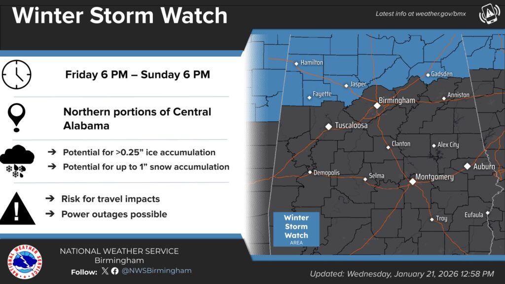
Uncertainty remains regarding how widespread the worst conditions will be and the level of impacts. A surge of frigid air is expected behind the system.
Ice could lead to power outages, tree damage, and extremely dangerous travel conditions. Officials urge residents to monitor forecast updates and consider delaying travel. If travel is unavoidable, drivers should use extreme caution and carry a winter storm emergency kit.