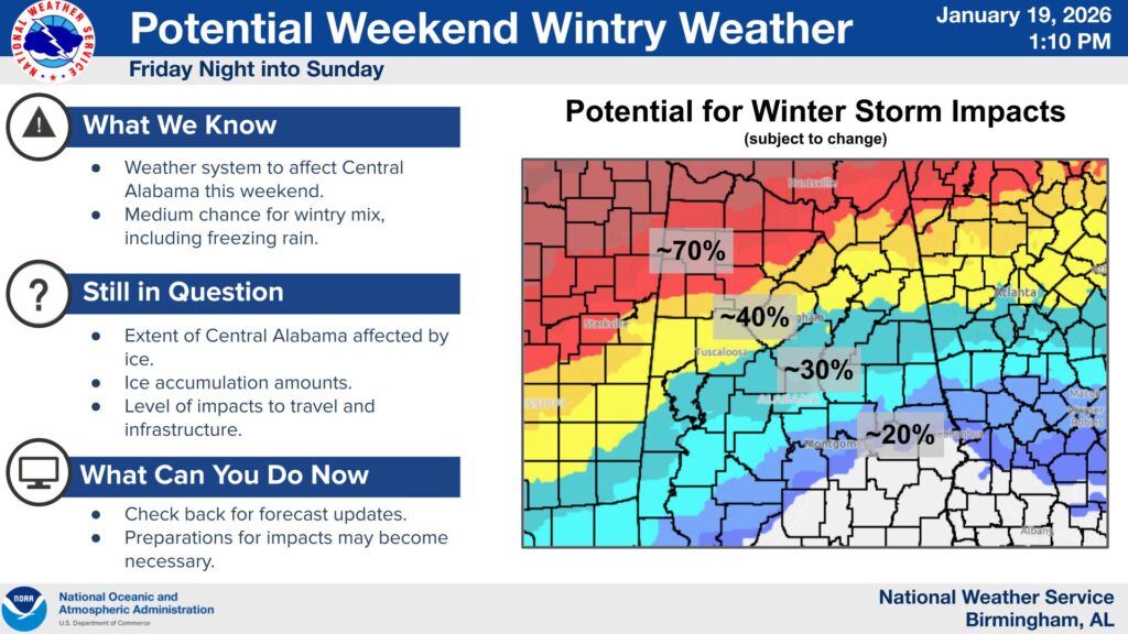
Forecasters say a potential winter weather system could bring a wintry mix to parts of Central Alabama this weekend, including freezing rain and ice.
According to the National Weather Service, there is a medium, 40 to 70 percent chance for impacts across areas near and north of Interstate 20. Officials caution that forecast probabilities could shift, and residents across the region are encouraged to monitor updates closely.
In addition to possible icing, a blast of arctic air is expected behind the system. Overnight temperatures could drop into the teens and 20s, increasing the risk of hazardous travel and infrastructure impacts.
Meteorologists warn that a worst-case scenario would involve significant icing combined with dangerously cold temperatures, particularly if power outages occur.
While it remains too early to pinpoint exact timing and severity, forecasters say confidence has increased enough to begin issuing daily updates.