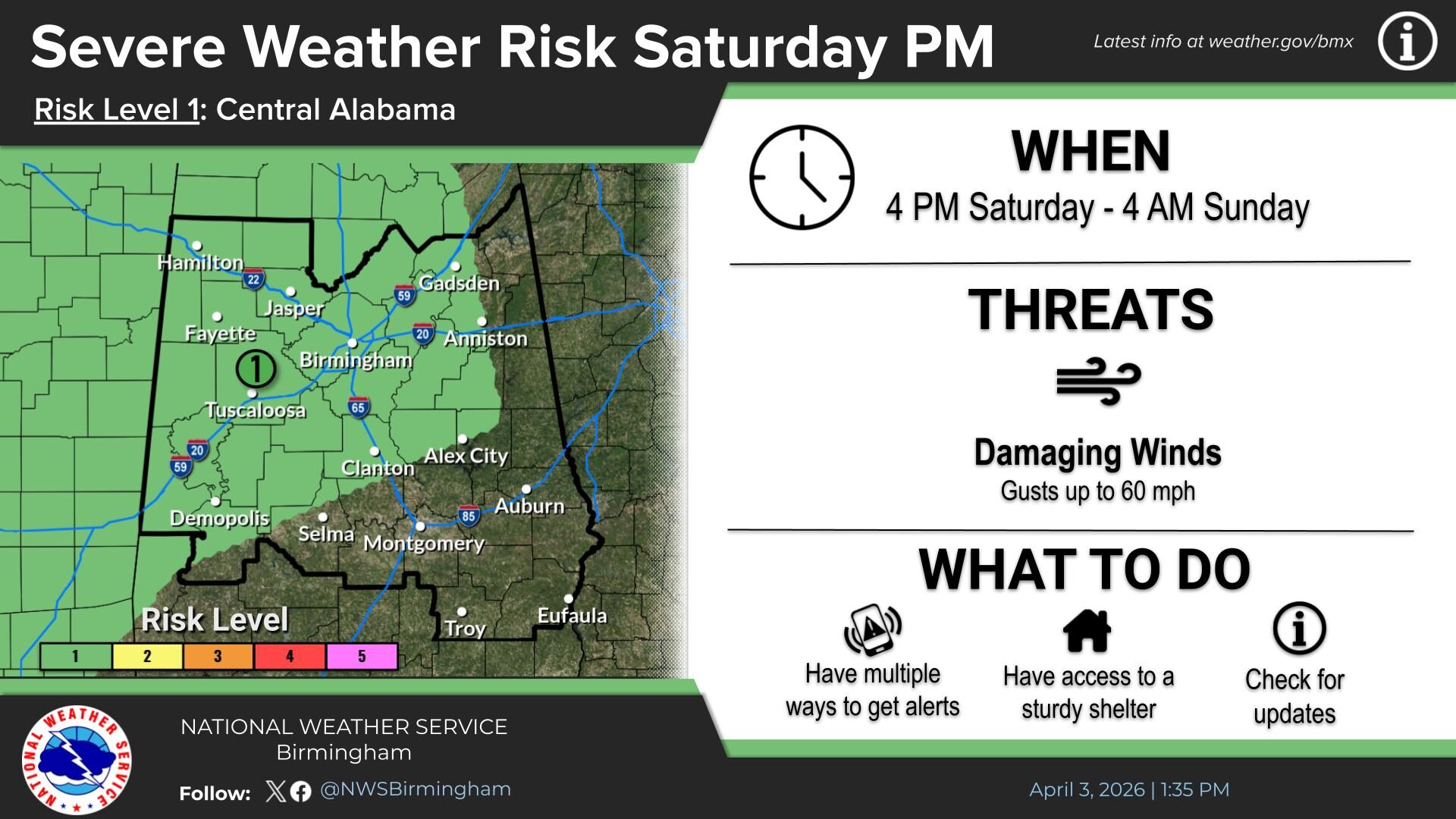
Flood Watch Issued for WEIS Listening Area Through Saturday Morning
A Flood Watch remains in effect for the WEIS listening area from 6 a.m. CST this morning through Saturday morning, as forecasters warn that heavy rainfall could lead to dangerous flooding conditions across much of central Alabama.
According to the National Weather Service, excessive rainfall during this period may result in flash flooding, particularly in low-lying and flood-prone areas. The watch includes numerous counties within the WEIS coverage area, including Cherokee, Etowah, Calhoun, Blount, St. Clair, Talladega, Randolph, Clay, Cleburne, Coosa, and surrounding counties.
Meteorologists expect widespread rainfall totals of two to four inches through Saturday morning, with isolated locations potentially receiving more than five inches. This amount of rainfall over a short period increases the risk of rapid runoff, which can overwhelm creeks, streams, rivers, and drainage systems.
Officials caution that flooding may also develop in urban areas and locations with poor drainage. Residents are urged to remain alert for changing weather conditions, avoid traveling across flooded roadways, and monitor local forecasts and emergency alerts.
The National Weather Service advises those living in flood-prone areas within the WEIS listening area to be prepared to take action should warnings be issued or conditions worsen.
https://weisradio.com/2026/01/08/nws-birmingham-warns-of-severe-storms-and-flooding-threat-fridaya/