Severe Storms, Heavy Rainfall Possible Across Central Alabama This Weekend
The National Weather Service (NWS) in Birmingham is forecasting the potential for strong to severe thunderstorms across Central Alabama beginning Friday afternoon and continuing into Saturday as a cold front moves through the region.
According to the NWS, thunderstorms are expected to develop early Friday afternoon and persist through late Friday night. Much of west-central Alabama is currently under a Slight Risk (Level 2 of 5) for severe weather. A Marginal Risk (Level 1 of 5) extends farther east toward the Alabama–Georgia state line.
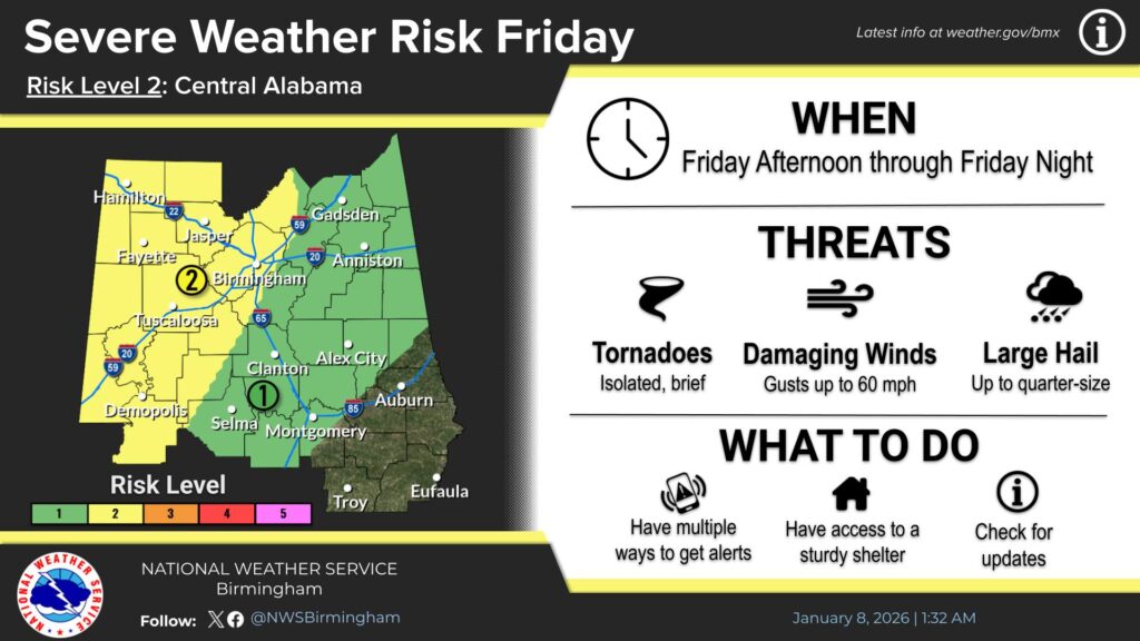
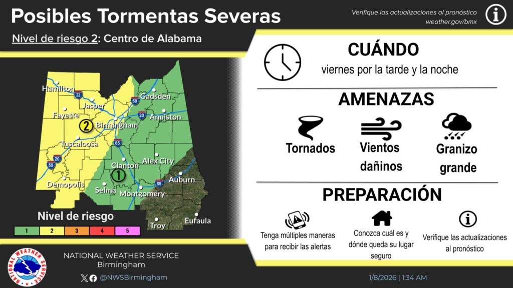
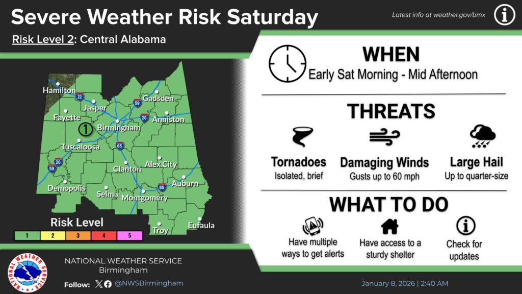
Meteorologists say the atmospheric conditions will be favorable for damaging straight-line winds, large hail, and the possibility of a few tornadoes. The threat for strong to severe storms is expected to continue into mid-afternoon Saturday as the cold front slowly advances through the area. A Marginal Risk for severe storms has been issued for much of Central Alabama on Saturday.
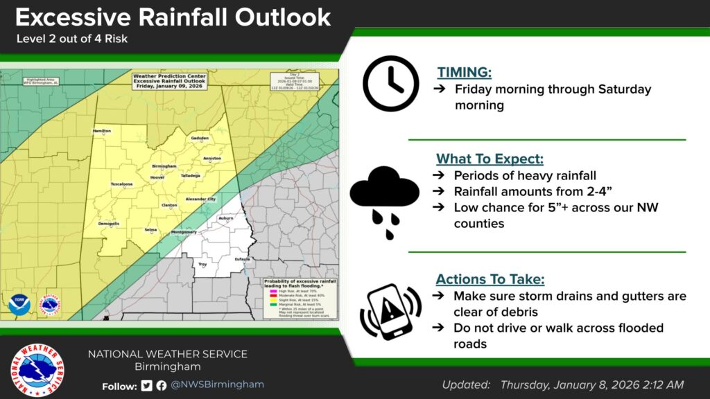
In addition to the severe weather threat, forecasters are also monitoring the potential for heavy rainfall. A slow-moving boundary associated with the system could lead to periods of heavy rain, with widespread rainfall totals of 2 to 4 inches expected. There is a low but notable chance that some locations in northwestern portions of the region could receive more than 5 inches of rain.
Residents are encouraged to stay informed of the latest forecasts and have multiple ways to receive weather warnings, particularly as conditions may change rapidly.