The National Weather Service Birmingham says rain and thunderstorms are expected to enter western and northwestern areas of Central Alabama between 6 and 8 a.m. Friday, spreading southeast throughout the morning.
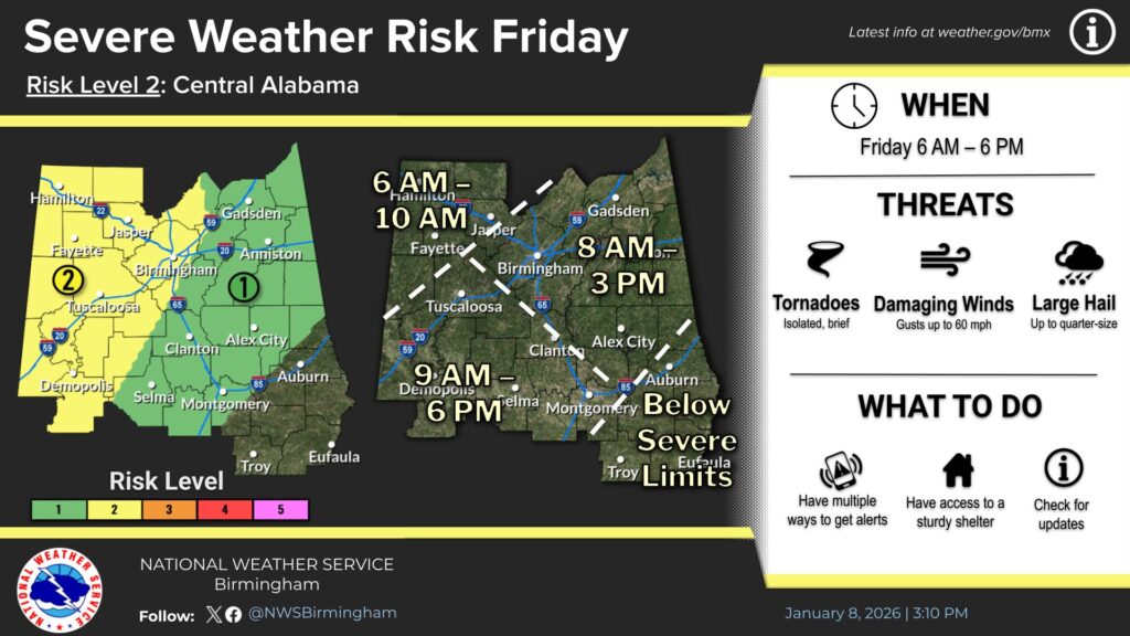
Forecast models indicate sufficient atmospheric instability to support the potential for severe weather from Friday morning through Friday evening. The highest risk for severe thunderstorms is expected across southwestern Central Alabama, particularly south and west of Tuscaloosa, from midday through early evening, where instability levels will be greatest. Other parts of Central Alabama will face a lower risk of severe storms.
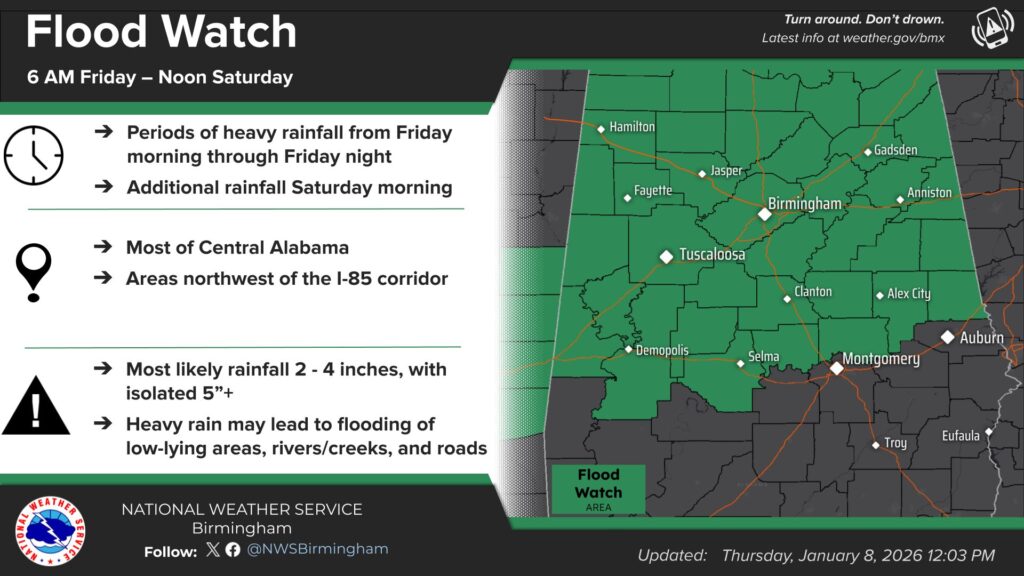
Heavy rainfall is also expected to continue Friday night into Saturday morning. Although rainfall will not be continuous, projected totals have led forecasters to issue a Flood Watch for much of Central Alabama, effective Friday morning through noon Saturday.
As the system moves out of the state, a Level 1 of 5 marginal risk for severe storms will remain in place Saturday morning through early afternoon for the southeastern half of Central Alabama.
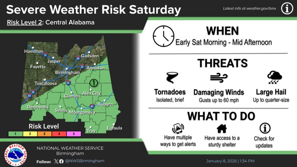
Potential hazards include damaging winds, brief tornadoes, large hail, and localized flash flooding. Residents are encouraged to remain weather-aware, closely monitor forecasts, and ensure they have multiple ways to receive weather alerts.
WEIS will keep you up to date.