Severe Storms Possible Friday
![]()
Area residents are being advised to stay alert as the potential for severe weather increases Friday afternoon through late Friday night, according to information from the Etowah County Emergency Management Agency.
Forecasters say a developing system associated with an approaching cold front could bring severe thunderstorms to the area. Etowah County and surrounding eastern counties are currently under a marginal risk for severe weather, categorized as a Level 1 out of 5 by the National Weather Service.
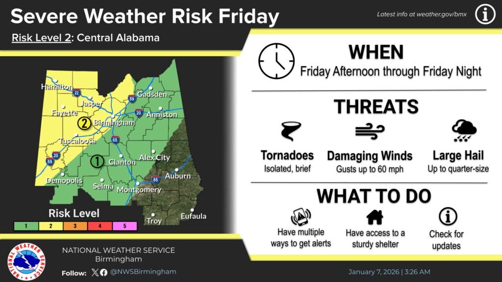
Primary threats include damaging wind gusts up to 60 miles per hour, brief and isolated tornadoes, and large hail that could reach quarter size. Heavy rainfall is also expected, raising concerns for localized flash flooding.
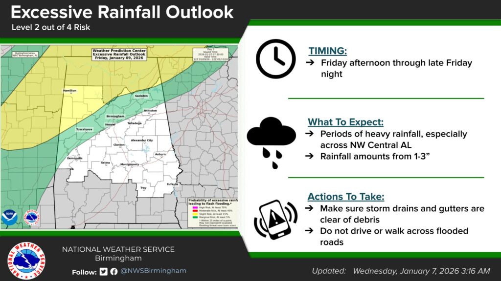
Officials noted that a slow-moving boundary could lead to periods of intense rainfall. Forecast totals range from two to three inches, which may result in flooding in low-lying or poor drainage areas across the county.
The Etowah County EMA said it will continue to monitor weather conditions and share updates as they become available. Residents are encouraged to stay informed through official National Weather Service channels at weather.gov/bmx.
Anyone with questions or in need of assistance can contact the Etowah County Emergency Management Agency at 256-549-5351.