The National Weather Service in Birmingham says two rounds of storms are expected Tuesday as a front moves across the state.
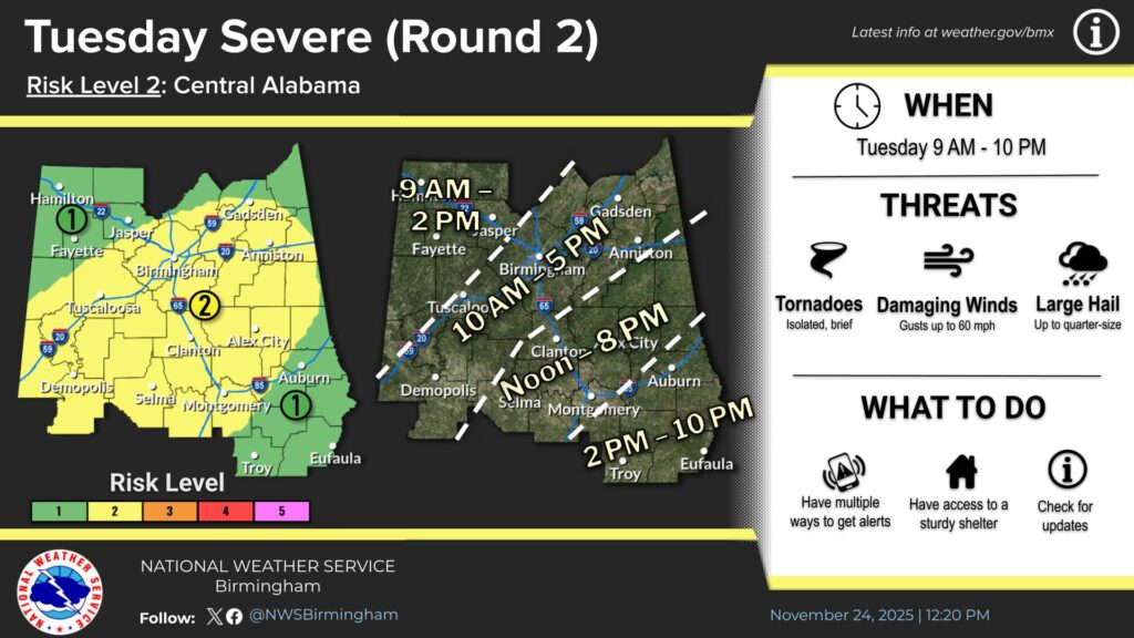
The first round is forecast to develop between 3 a.m. and 7 a.m. mainly across west Alabama. A second, more widespread round is expected from 9 a.m. through 10 p.m. across all of central Alabama.
Forecasters say both rounds could produce damaging winds up to 60 miles per hour, large hail up to quarter size, and a brief or isolated tornado. For the second round, the tornado threat may give way to a stronger straight-line wind threat later in the day.
The Weather Service has added a Slight Risk — level 2 out of 5 — for the second round of storms.
Residents are encouraged to stay weather aware and be prepared to act if warnings are issued.