From the National Weather Service in Birmingham:
Flood Advisory
Flood Advisory
National Weather Service Birmingham AL
401 PM CDT Tue Jun 17 2025
…FLOOD ADVISORY IN EFFECT UNTIL 730 PM CDT THIS EVENING…
* WHAT…Urban and small stream flooding caused by excessive rainfall is expected.
* WHERE…A portion of central Alabama, including the following counties, Calhoun, Shelby, St. Clair and Talladega.
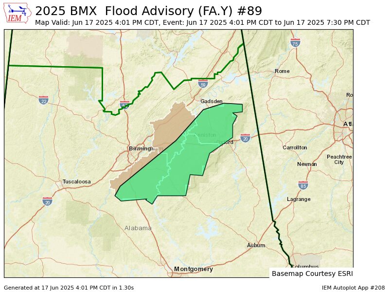
* WHEN…Until 730 PM CDT.
* IMPACTS…Minor flooding in low-lying and poor drainage areas. Water over roadways.
* ADDITIONAL DETAILS…
– At 401 PM CDT, Doppler radar indicated heavy rain due to thunderstorms. This will cause urban and small stream flooding. Between 1 and 2 inches of rain have fallen.
– Additional rainfall amounts up to 1.5 inches are expected over the area. This additional rain will result in minor flooding.
– Some locations that will experience flooding include…
Alabaster, Anniston, Pelham, Oxford, Talladega, Sylacauga, Pell City, Jacksonville, Calera, Chelsea, Montevallo, Childersburg, Piedmont, Columbiana, Wilsonville, Talladega Springs, West End-Cobb Town, Cobb Town, Saks and Fort McClellan.
PRECAUTIONARY/PREPAREDNESS ACTIONS…
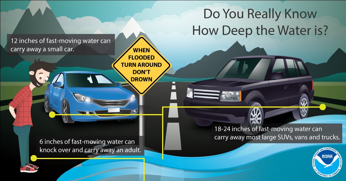
Turn around, don’t drown when encountering flooded roads. Most flood deaths occur in vehicles.
Stay with WEIS 100.5 FM, 990 AM, and the WEIS Radio app for the latest weather updates.