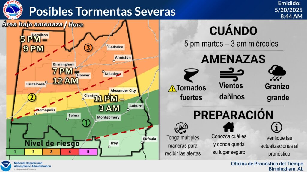
From The National Weather Service in Birmingham:
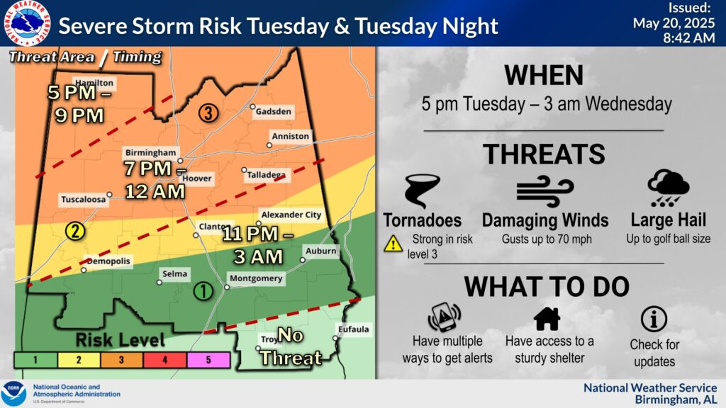
SEVERE UPDATE: Good morning everyone! Conditions will be warm and partly sunny throughout much of the day today. We do have an active period ahead of us beginning late this afternoon and continuing into tonight as a line and perhaps clusters of strong thunderstorms move through the area from northwest to southeast. The greatest threat will be across the northern half of Central Alabama where there is a Level 3 out of 5 risk of severe storms. Threats include tornadoes, some of which could be strong in the Level 3 area, damaging wind gusts up to 70 mph, and large hail up to golf ball size.
Ways to receive the warnings -> Make sure that you have wireless emergency alerts enabled on your smartphone (check in the settings), TV, internet, FM radio, weather apps, and county emergency notification subscriptions are some of the options you can choose from.