From the National Weather Service in Birmingham:
There will be potential for a few severe storms capable of producing damaging winds to 60 mph and large hail to quarter size from 4 pm to 10 pm while a flood watch remains in effect until 7 pm. Heavy rainfall will continue today and may result in localized flooding.
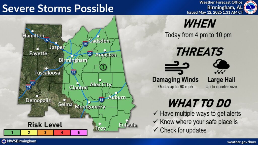
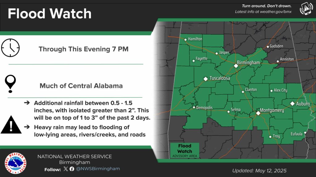
Hazardous Weather Outlook
National Weather Service Birmingham AL
204 AM CDT Mon May 12 2025

ALZ011>015-017>050-131015-
Marion-Lamar-Fayette-Winston-Walker-Blount-Etowah-Calhoun-Cherokee-
Cleburne-Pickens-Tuscaloosa-Jefferson-Shelby-St. Clair-Talladega-
Clay-Randolph-Sumter-Greene-Hale-Perry-Bibb-Chilton-Coosa-Tallapoosa-
Chambers-Marengo-Dallas-Autauga-Lowndes-Elmore-Montgomery-Macon-
Bullock-Lee-Russell-Pike-Barbour-
204 AM CDT Mon May 12 2025

This Hazardous Weather Outlook is for the counties served by the
National Weather Service office in Birmingham.

.DAY ONE...Outlook through Tonight.

There is a marginal risk (level 1 out of 5) for severe thunderstorms
across the eastern portions of Central Alabama this afternoon and
evening from 4 pm to 10 pm. Threats include damaging wind gusts up to
60 mph and hail up to quarter size.

In addition, there is a threat of flooding from heavy rainfall
across much of Central Alabama through tonight.