There is a slight risk for severe thunderstorms this afternoon and evening across the region. The best chances will come across the northern part of the area. All forms of severe weather are possible including damaging winds, large hail and potential for a brief tornado or two.
Hazardous Weather Outlook
Hazardous Weather Outlook
National Weather Service Birmingham AL
201 AM CDT Thu May 8 2025
This Hazardous Weather Outlook is for the counties served by the National Weather Service office in Birmingham.
.DAY ONE…Outlook through Tonight.
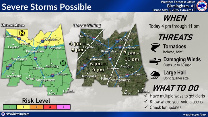
A disturbance will trigger shower and thunderstorm activity across Northern portions of Central Alabama this afternoon and evening from 4 pm to 11 pm. Damaging wind gusts to 60 mph, large hail up to quarter size and a tornado or two will be possible with this activity.
.DAYS TWO THROUGH SEVEN…Thursday through Tuesday.
No hazardous weather is expected at this time.
.SPOTTER INFORMATION STATEMENT…
Activation of storm spotters and emergency management may be needed this afternoon and evening.