From the National Weather Service in Birmingham:
Freeze Warning
URGENT – WEATHER MESSAGE
National Weather Service Birmingham AL
116 AM CDT Tue Apr 8 2025
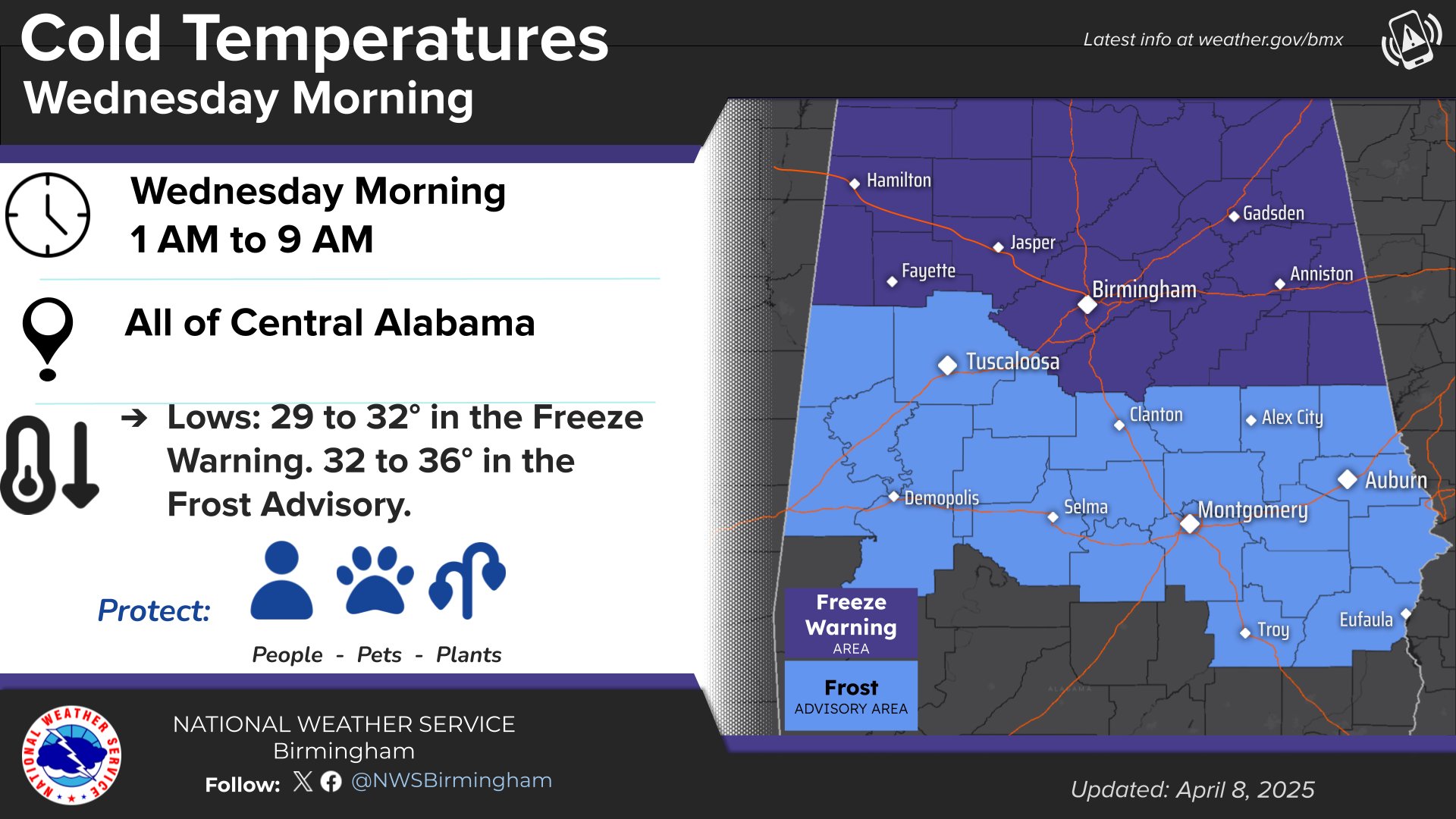
…FREEZE WARNING IN EFFECT FROM 1 AM TO 9 AM CDT WEDNESDAY…
* WHAT…Sub-freezing temperatures from 29 to 31 degrees expected.
* WHERE…Blount, Calhoun, Cherokee, Clay, Cleburne, Etowah, Fayette, Jefferson, Lamar, Marion, Randolph, Shelby, St. Clair, Talladega, Walker, and Winston Counties.
* WHEN…From 1 AM to 9 AM CDT Wednesday.
* IMPACTS…Frost and freeze conditions could kill crops, other sensitive vegetation and possibly damage unprotected outdoor plumbing.
PRECAUTIONARY/PREPAREDNESS ACTIONS…
Take steps now to protect tender plants from the cold.
Those that have in ground sprinkler systems should drain them and cover above ground pipes to protect them from freezing.
From the National Weather Service in Huntsville:
Freeze Warning
URGENT – WEATHER MESSAGE
National Weather Service Huntsville AL
1236 AM CDT Tue Apr 8 2025
…FREEZE WARNING IN EFFECT FROM 1 AM TO 9 AM CDT WEDNESDAY…
* WHAT…Sub-freezing temperatures as low as 29 degrees expected.
* WHERE…Portions of north central, northeast, and northwest Alabama.
* WHEN…From 1 AM to 9 AM CDT Wednesday.
* IMPACTS…Frost and freeze conditions could kill crops, other sensitive vegetation and possibly damage unprotected outdoor plumbing.
PRECAUTIONARY/PREPAREDNESS ACTIONS…
Take steps now to protect tender plants from the cold.
Stay with WEIS 100.5 FM, 990 AM, and the WEIS Radio app for the latest weather updates.