
From the National Weather Service in Birmingham:
Regarding Potential for Severe Weather this weekend
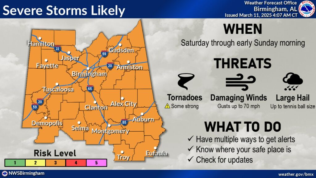
3/11:  SATURDAY THRU SUNDAY MORNING: Severe storms now appear LIKELY (Level 3 out of 5 risk) with a potential for tornadoes (some strong), wind gusts up to 70mph, and large hail (perhaps up to tennis ball size). Storms should end by 7am Sunday morning for E and SE counties.
UNCERTAINTIES STILL EXIST, CHECK BACK FOR UPDATES: We’re still 4-5 days away from this event, with more fine tuning of the forecast expected to be made – including more specific timing between the different rounds of severe storms. Stay tuned, and make sure you have your severe weather plan ready to go before the weekend gets here!
WEIS Radio will continue to monitor the situation, and will update as we get closer to the weekend and as forecast change, or more information becomes available.


You must be logged in to post a comment.