Winter Weather Advisory Update:
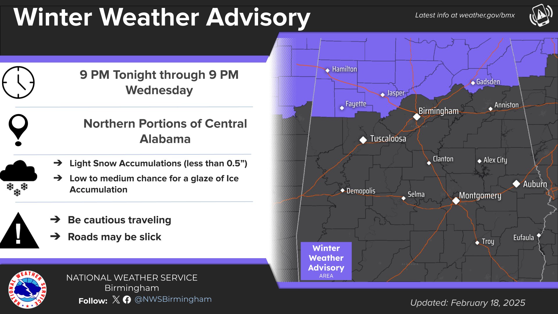
The National Weather Service out of Birmingham has issued a Winter Weather Advisory Beginning at 9PM on Tuesday, Feb 18th, lasting until Wed Morning, Feb 19th at 9:00 AM.
Rain could possibly turn into a winter mix this evening. This effects Blount, Cherokee, Etowah, and Marion and Winston Counties. It includes the cities of Centre, Gadsden, Double Springs, and Onteonta.
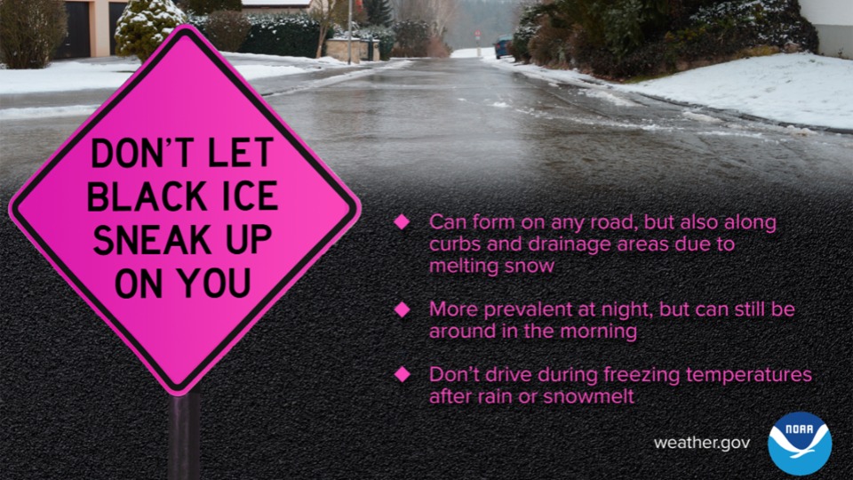
Expect impacts on roads, especially on bridges and overpasses, where conditions are likely to become slick and hazardous. Plan on slippery road conditions that could impact your Wednesday morning commute.
Of course we will keep an eye on this system. As of now the impacts are expected mostly near and north of the Hwy 278 Corridor, which puts most of Cherokee and Etowah County on the extreme southern edge of the system. A shift north could lead to little impact, but a southern shift could raise the chances significantly. The chances as of snow accumulation as of 6 AM this morning are shown in the NWS graphic sent to us below:

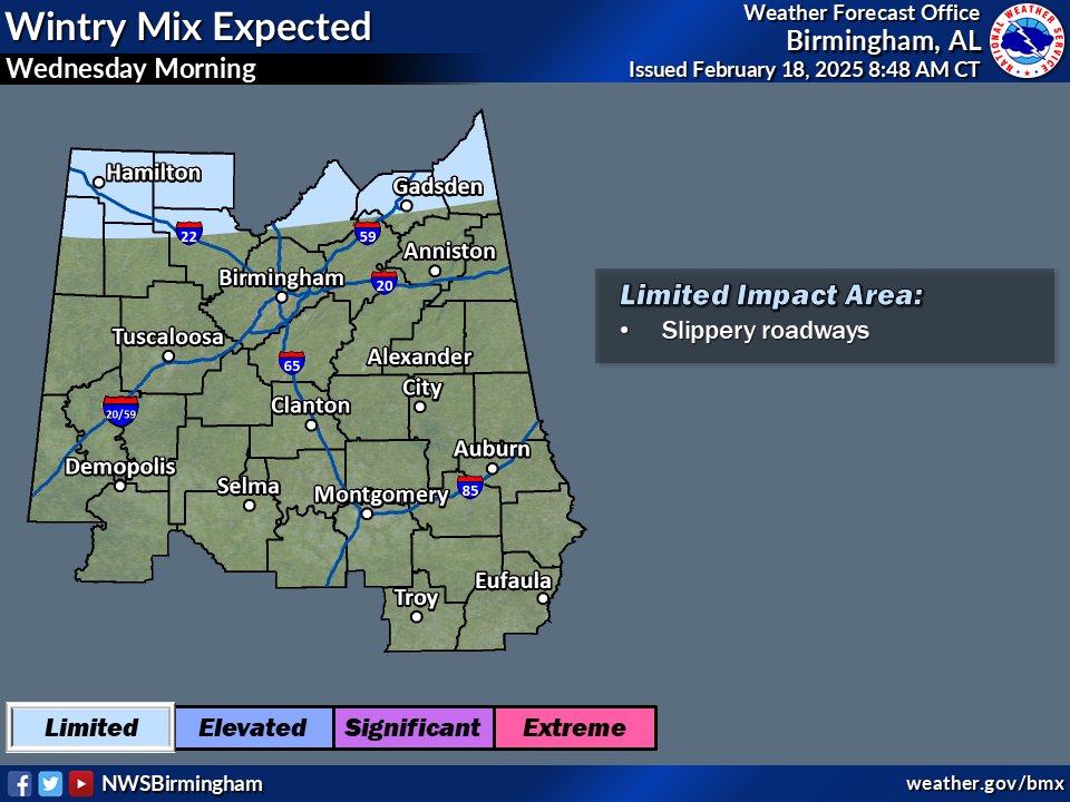
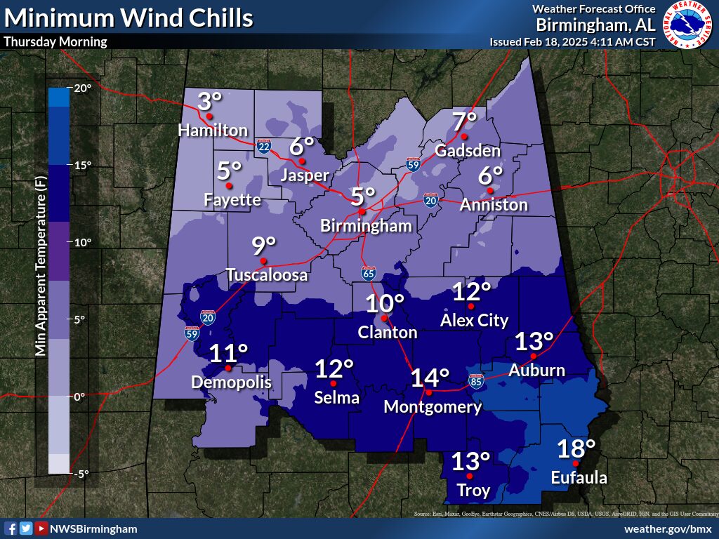
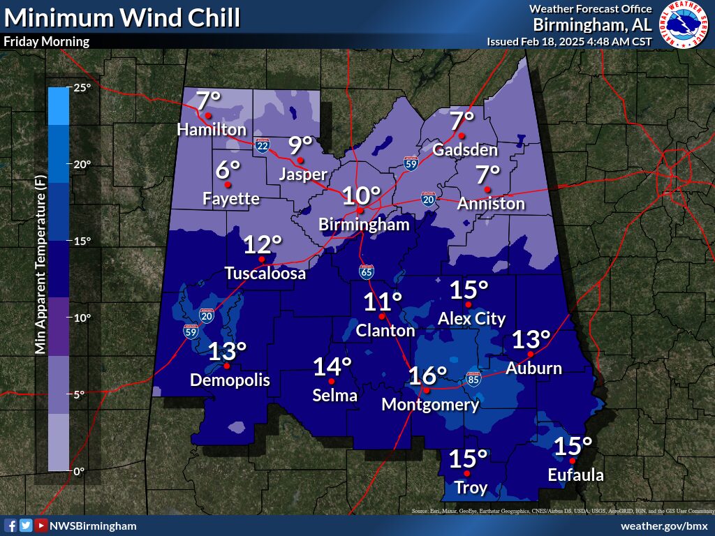
Following the potential winter event over night Tuesday into Wednesday, expect temperatures to get up to near 45 on Wednesday. It will be cloudy with Northeast Wind around 5MPH. Little or no further snow accumulation is expected during the afternoon or Wed Evening. It will become extremely cold overnight going into Thursday though, look for very low temps and wind chill on Thursday and Friday Morning.
We will continue to monitor the situation and stay in contact with the NWS through the event and the next few days. Check in frequently for updates to see if the forecast changes, or any additional information becomes available.
The Complete Advisory from the National Weather Service in Birmingham is available below:
URGENT - WINTER WEATHER MESSAGE
National Weather Service Birmingham AL
201 AM CST Tue Feb 18 2025

ALZ011-014-017-018-020-181615-
/O.NEW.KBMX.WW.Y.0003.250219T0300Z-250219T1500Z/
Marion-Winston-Blount-Etowah-Cherokee-
Including the cities of Centre, Gadsden, Double Springs,
Hamilton, and Oneonta
201 AM CST Tue Feb 18 2025

...WINTER WEATHER ADVISORY IN EFFECT FROM 9 PM THIS EVENING TO 9 AM
CST WEDNESDAY...

* WHAT...Mixed precipitation expected. Total snow accumulations up
  to one inch and ice accumulations around a light glaze.

* WHERE...Blount, Cherokee, Etowah, Marion, and Winston Counties.

* WHEN...From 9 PM this evening to 9 AM CST Wednesday.

* IMPACTS...Roads, and especially bridges and overpasses, will
  likely become slick and hazardous. Plan on slippery road
  conditions. The hazardous conditions could impact the Wednesday
  morning commute.

PRECAUTIONARY/PREPAREDNESS ACTIONS...

Slow down and use caution while traveling.
From the National Weather Service in Huntsville:
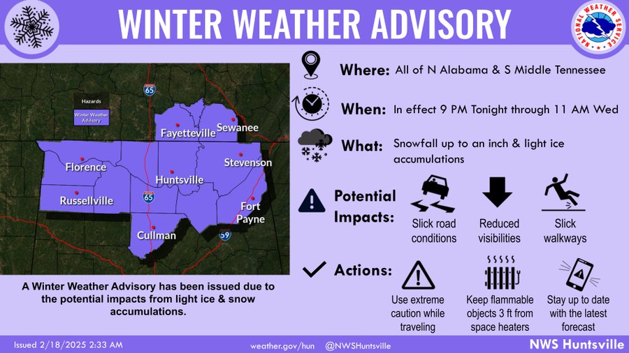
URGENT - WINTER WEATHER MESSAGE
National Weather Service Huntsville AL
104 AM CST Tue Feb 18 2025

ALZ001>010-016-TNZ076-096-097-182300-
/O.NEW.KHUN.WW.Y.0003.250219T0300Z-250219T1700Z/
Lauderdale-Colbert-Franklin AL-Lawrence-Limestone-Madison-Morgan-
Marshall-Jackson-DeKalb-Cullman-Moore-Lincoln-Franklin TN-
Including the cities of Sewanee, Scottsboro, Muscle Shoals,
Fayetteville, Arab, Town Creek, Decherd, Sheffield, Red Bay,
Lynchburg, Cullman, Estill Springs, Moulton, Rainsville,
Albertville, Cowan, Florence, Guntersville, Athens, Winchester,
Russellville, Fort Payne, Huntsville, Decatur, Tuscumbia, and
Boaz
104 AM CST Tue Feb 18 2025

...WINTER WEATHER ADVISORY IN EFFECT FROM 9 PM THIS EVENING TO 11 AM
CST WEDNESDAY...

* WHAT...Mixed precipitation expected. Total snow accumulations up
  to one inch and ice accumulations around a light glaze.

* WHERE...Portions of north central, northeast, and northwest
  Alabama and southern middle Tennessee.

* WHEN...From 9 PM this evening to 11 AM CST Wednesday.

* IMPACTS...Plan on slippery road conditions. The hazardous
  conditions could impact the Wednesday morning commute.

PRECAUTIONARY/PREPAREDNESS ACTIONS...

Slow down and use caution while traveling. The latest road
conditions for the state you are calling from can be obtained by
calling 5 1 1.