

From the National Weather Service in Birmingham:
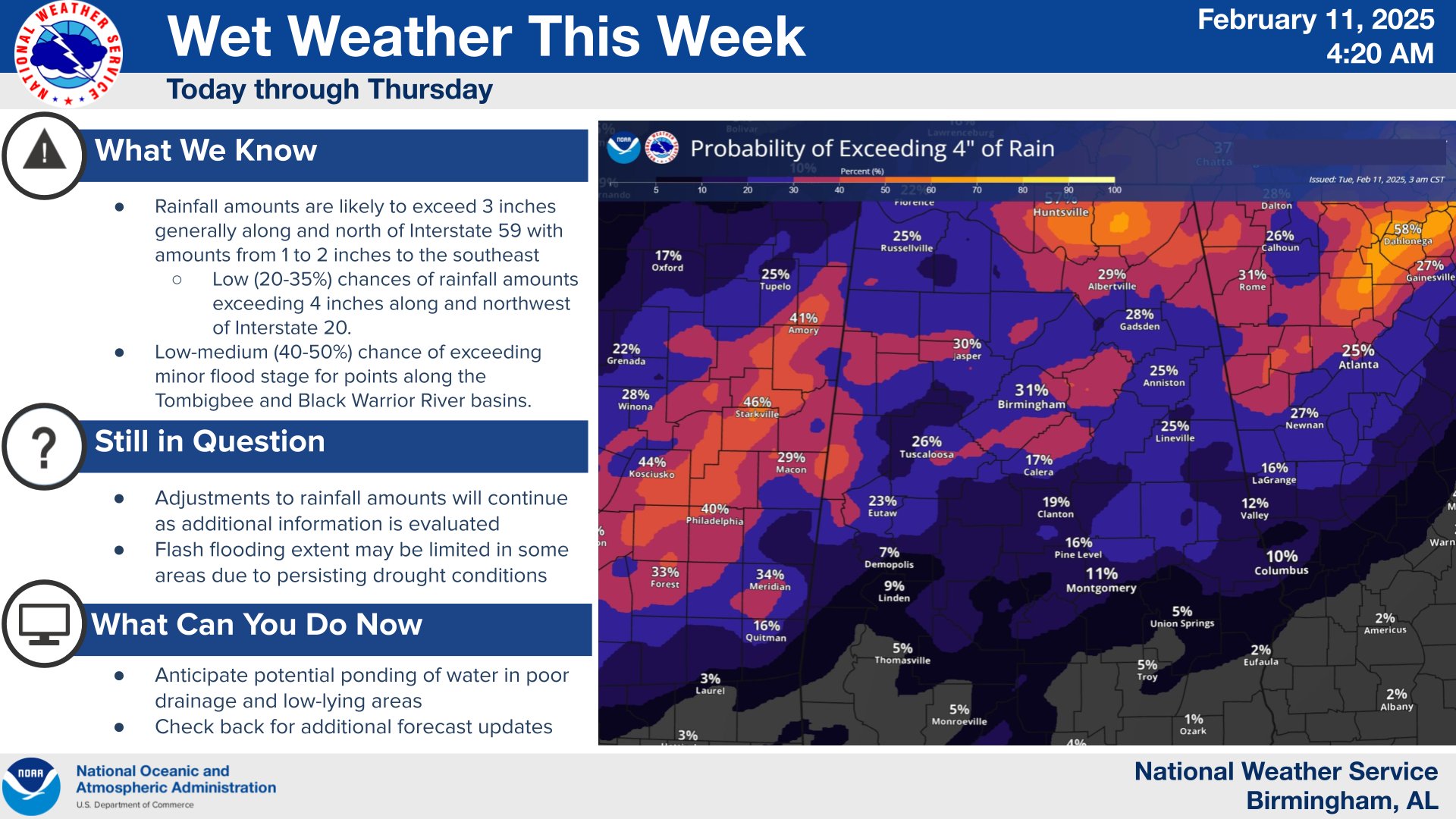
Our wet pattern begins today. There’s a low (20-35%) chance of storm total rainfall amounts exceeding 4″ w/ lower amounts expected southeast. There will be a low-medium (40-50%) chance for minor river flooding across portions of Central Alabama during this time frame as well.
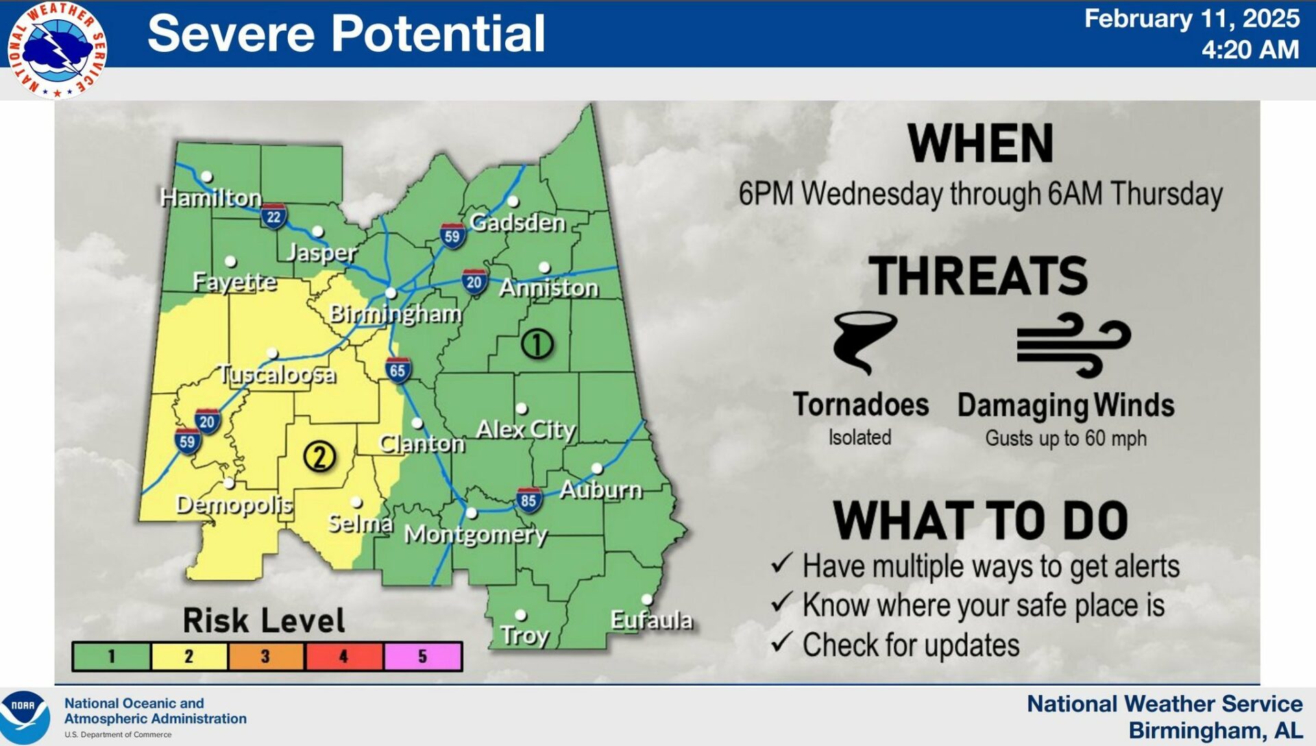
Today, light rain will move through the area through the early morning, with heavier rain beginning to move into the area by late morning. This activity should increase in coverage through the afternoon and evening. There is just enough energy and shear (turning of the winds) for storms to use and become strong to severe. Though there is a low chance for tornadoes, the environment could support a brief tornado or two. Damaging winds will also be a threat, with gusts up to 60 mph in the stronger storms.
With severe weather possible today, Wednesday night, and again on Saturday, now is a great time to start looking at safety locations and how to receive warnings!
Hazardous Weather Outlook
National Weather Service Birmingham AL
257 AM CST Tue Feb 11 2025
This Hazardous Weather Outlook is for the counties served by the National Weather Service office in Birmingham.
.DAY ONE…Outlook through Tonight.
Heavy rainfall this afternoon will produce a low chance of minor flooding, mainly of poor drainage and low-lying areas for points along and north of Interstate 20.
.DAYS TWO THROUGH SEVEN…Wednesday through Monday.
Moderate to heavy rainfall is expected to continue Wednesday through Thursday morning. Additional rainfall accumulations of 1 to 4 inches may result in minor flooding of low-lying and poor drainage areas with a low risk of isolated flash flooding for points generally near and north of Interstate 20.
There is a low to moderate risk for a few strong to severe storms Wednesday afternoon through Wednesday night across much of Central Alabama, especially the southern half. Threats include damaging wind gusts up to 60 mph and a brief tornado or two.
There is a low risk for strong to severe storms Saturday night into Sunday morning across Central Alabama.
.SPOTTER INFORMATION STATEMENT…
Activation of storm spotters and emergency management may be needed from Tuesday through Thursday.
Stay with WEIS 100.5 FM, 990 AM, and the WEIS Radio app for the latest weather updates.


