Cherokee County Weather Alert: Flooding & Severe Weather Risk:
From The Cherokee County EMA:
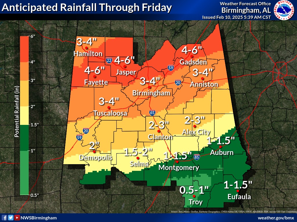
We are closely monitoring a prolonged period of wet weather expected from Tuesday through Thursday. The National Weather Service (NWS) Birmingham has forecasted waves of moderate to heavy rainfall, with 4 to 6 inches of rain possible.
Key Concerns:
Flooding Risks: Low to medium chances of minor river flooding and flooding in low-lying areas.
Severe Weather Threat: A low risk of severe storms on Wednesday night, mainly in western and southwestern parts of the area, with damaging winds up to 60 mph and a brief tornado possible.
What You Can Do:
Stay Alert: Have multiple ways to receive emergency alerts.
Know Your Safe Place: Prepare for potential severe weather impacts.
Monitor Updates: Keep track of local weather reports and warnings.
There is the potential for some strong to severe storms over the weekend. We will provide a detailed update on developing conditions as we get closer to Friday/Saturday.
Cherokee County residents are urged to take precautions and stay informed.
For updates download our free mobile app and signup for Code Red Alerts.
Cherokee Co. EMA Mobile App: https://apps.myocv.com/share/a30535960