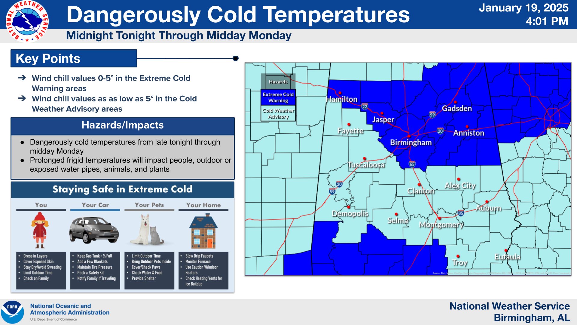
Extreme Cold Warning
URGENT – WEATHER MESSAGE
National Weather Service Birmingham AL
420 AM CST Mon Jan 20 2025
…EXTREME COLD WARNING REMAINS IN EFFECT UNTIL 11 AM CST THIS MORNING…
* WHAT…Dangerously cold wind chills as low as 0.
* WHERE…Blount, Calhoun, Cherokee, Clay, Cleburne, Etowah, Jefferson, Marion, Randolph, Shelby, St. Clair, Talladega, Walker, and Winston Counties.
* WHEN…Until 11 AM CST this morning.
* IMPACTS…Frostbite and hypothermia will occur if unprotected skin is exposed to these temperatures. An extended period of subfreezing temperatures could cause pipes to burst.

PRECAUTIONARY/PREPAREDNESS ACTIONS…
Dress in layers including a hat, face mask, and gloves if you must go outside.
Keep pets indoors as much as possible.
Make frequent checks on older family, friends, and neighbors. Ensure portable heaters are used correctly. Do not use generators or grills inside.
To prevent freezing and possible bursting of pipes they should be wrapped, drained, or allowed to drip slowly.

Extreme Cold Warning
URGENT – WEATHER MESSAGE
National Weather Service Huntsville AL
Issued by National Weather Service Birmingham AL
335 AM CST Mon Jan 20 2025
…EXTREME COLD WARNING REMAINS IN EFFECT UNTIL NOON CST TODAY…
* WHAT…Dangerously cold wind chills below minus 5 expected.
* WHERE…In Alabama, Cullman, DeKalb, Jackson, and Marshall Counties. In Tennessee, Franklin TN and Moore Counties.
* WHEN…Until noon CST today.
* IMPACTS…Frostbite and hypothermia will occur if unprotected skin is exposed to these temperatures. Very cold temperatures can lead
to hypothermia with prolonged exposure.
PRECAUTIONARY/PREPAREDNESS ACTIONS…
Dress in layers including a hat, face mask, and gloves if you must go outside.
To prevent water pipes from freezing; wrap or drain or allow them to drip slowly.
Make sure outdoor animals have a warm, dry shelter, food, and unfrozen water.
Make frequent checks on older family, friends, and neighbors. Ensure portable heaters are used correctly. Do not use generators or grills inside.