Hazardous Weather Outlook
Hazardous Weather Outlook
National Weather Service Birmingham AL
350 AM CST Fri Dec 27 2024
Marion-Lamar-Fayette-Winston-Walker-Blount-Etowah-Calhoun-Cherokee-Cleburne-Pickens-Tuscaloosa-Jefferson-Shelby-St. Clair-Talladega-Clay-Randolph-Sumter-Greene-Hale-Perry-Bibb-Chilton-Coosa-Tallapoosa-Chambers-Marengo-Dallas-Autauga-LowndesElmore-Montgomery-Macon-Bullock-Lee-Russell-Pike-Barbour-
This Hazardous Weather Outlook is for the counties served by the National Weather Service office in Birmingham.
.DAY ONE…Outlook through Tonight.
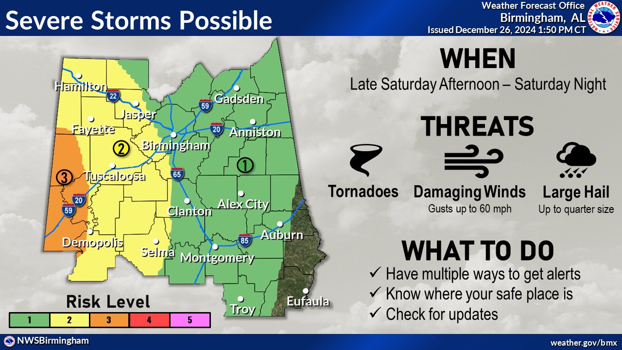
A low risk for severe storms will develop across southwestern portions of the area this afternoon with storms capable of producing a brief tornado, damaging wind gusts up to 60 mph, and quarter size hail.
.DAYS TWO THROUGH SEVEN…Saturday through Thursday.
Strong to severe storms capable of producing tornadoes, with a strong tornado possible, damaging wind gusts up to 60 mph, and quarter size hail will be likely across Central Alabama late Saturday afternoon through early Sunday morning.
.SPOTTER INFORMATION STATEMENT…
Activation of storm spotters and emergency management may be needed this afternoon and again on Saturday.