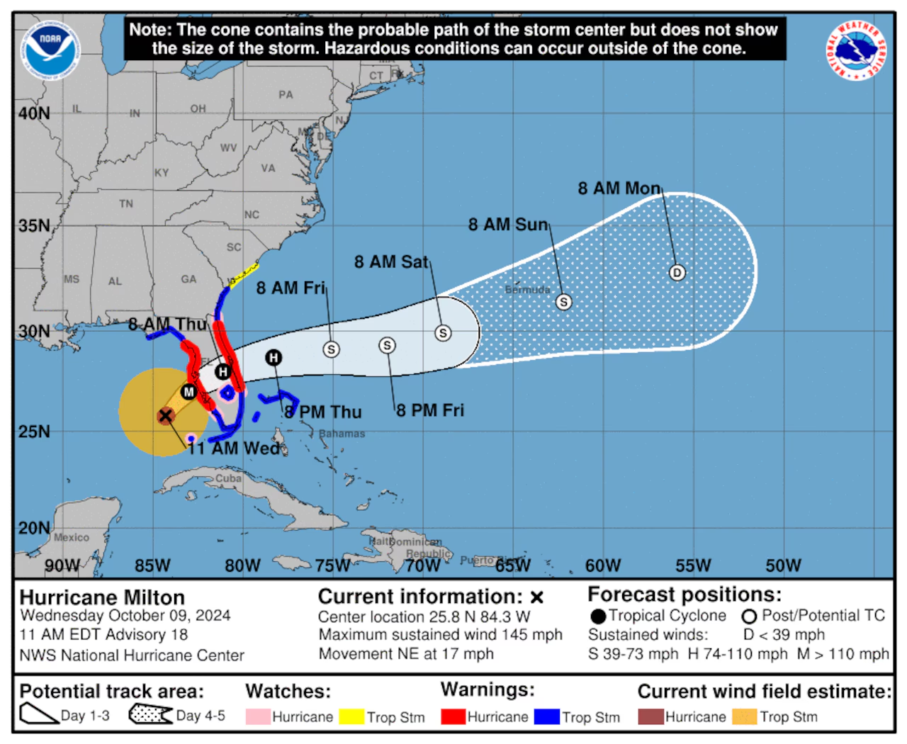
The National Hurricane Center has said that Hurricane Milton remained a “catastrophic” Category 4 hurricane on Wednesday, and was picking up speed as it approached Florida.
Milton is expected to make landfall on Florida’s west coast late tonight.
Milton had 145 mph winds Wednesday morning but could weaken some more before landfall. However – forecasters warn that Milton could still be a major hurricane when it makes it to the coast. A potentially devastating storm surge, damaging winds and flooding rain will be possible along both west and east coasts of Florida – as the storm moves across the peninsula overnight tonight. The peninsula was also littered with tornado warnings on Wednesday as rain bands from the storm moved onshore – and – forecasters expect the tornado threat to climb through this afternoon.
As of 10:00am CDT today/Wednesday the center of Category 4 Hurricane Milton was located about 190 miles southwest of Tampa and it was also tracking to the northeast at 17 mph. Milton had 145 mph winds, making it a solid Category 4 hurricane (the wind speeds for Category 4 can range from 140 mph to 156 mph)
Milton will not directly affect the Alabama coast except for the continued high risk for rip currents through Thursday.


