Helene weakened to a “Tropical Storm” early this (Friday) morning, over Georgia after making landfall late Thursday as a Category 4 Hurricane on Florida’s Big Bend; at this point – the extent of any damage from Helene – does remain unknown – however, the National Weather Service Office in Tallahassee, located very close to the landfall point has gotten numerous reports of storm surge and freshwater flooding, trees on homes, and also a number of impassable roadways before daylight. Helene made landfall Thursday night as a Category 4 Hurricane – around 10:10pm with 140 mph winds, near Perry, Florida – according to reports from the National Hurricane Center.
Alabama has apparently been spared the worst of Helene and all tropical Storm Warnings have been dropped for the state. The National Weather Service Offices that cover the state have gotten several reports of heavy rain and flooding in east Alabama overnight – but, there were NO ACTIVE Flash Flood Warnings in the state. That wasn’t the case, to the east, with multiple Flash Flood Warnings that were issued across Georgia and the Carolinas:
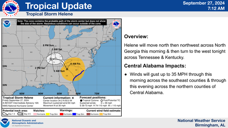
According to the National Hurricane Center, as of 4:00am CDT, the center of Tropical Storm Helene was about 40 miles east of Macon, Georgia, and it was moving north very fast at 30 mph. Helene had winds of 70 mph – making it a strong tropical storm. The Hurricane Center expects Helene to continue to weaken – and, become a non-tropical storm this afternoon or tonight.
Helene isn’t exactly done however.
Flash Flood Warnings are proliferating across Georgia and the Carolinas this (Friday) morning and that storm could bring a total of 6 to 12 inches of rain to the Southeast. That much rain could bring significant Flash Flooding and possibly some landslides across the southern Appalachians. A few tornadoes continue to be possible, in east Georgia – the Carolinas – and into southern Virginia.
Many of those coastal Watches and Warnings have been dropped, but the the Storm Surge Warning remains in Florida – from Indian Pass to Bonita Beach, and Tampa Bay – a Storm Surge of 5 to 10 feet, is STILL possible in parts of the Storm Surge Warning area.
(Combined Sources/www.AL.COM/National Weather Service)