***UPDATE: Tropical Storm Warning Cancelled
Helene Local Watch/Warning Statement/Advisory Number 14
National Weather Service Birmingham AL AL092024
352 PM CDT Thu Sep 26 2024
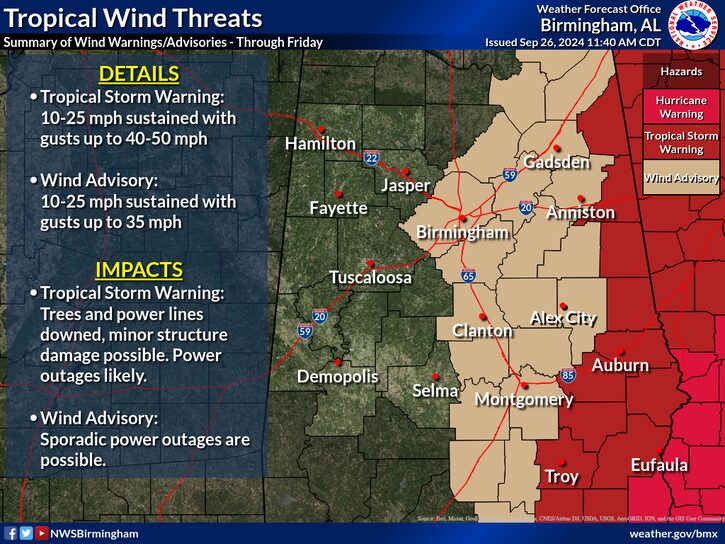
…TROPICAL STORM WARNING REMAINS IN EFFECT…
* LOCATIONS AFFECTED
– Centre
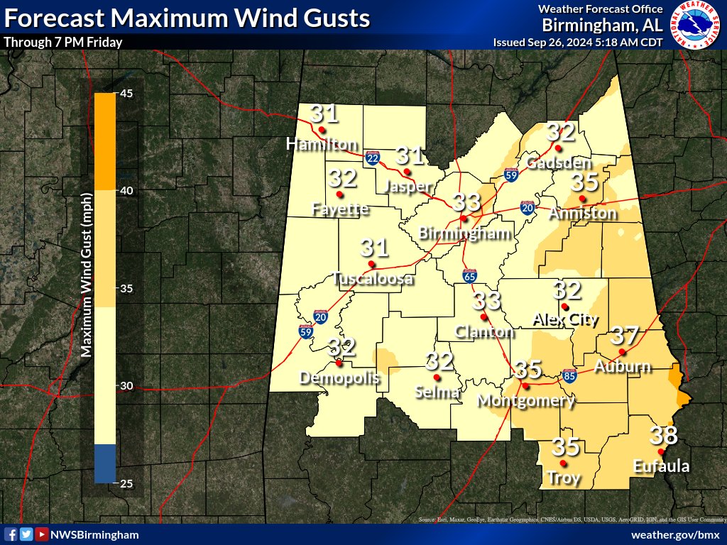
* WIND
– LATEST LOCAL FORECAST: Below tropical storm force wind
– Peak Wind Forecast: 15-25 mph with gusts to 35 mph
– THREAT TO LIFE AND PROPERTY THAT INCLUDES TYPICAL FORECAST UNCERTAINTY IN TRACK, SIZE AND INTENSITY: Potential for wind 39 to 57 mph
– The wind threat has remained nearly steady from the previous assessment.
– PLAN: Plan for hazardous wind of equivalent tropical storm force.
– PREPARE: Remaining efforts to protect property should be completed as soon as possible. Prepare for limited wind damage.
– ACT: Move to safe shelter before the wind becomes hazardous.
– POTENTIAL IMPACTS: Limited
– Damage to porches, awnings, carports, sheds, and unanchored mobile and manufactured homes. Unsecured lightweight objects blown about.
– Many large tree limbs broken off. A few trees snapped or uprooted, especially weaker trees. Some fences and roadway signs blown over.
– A few roads impassable from debris, particularly within urban or heavily wooded places. Hazardous driving conditions on bridges and other elevated roadways.
– Scattered power and communications outages.
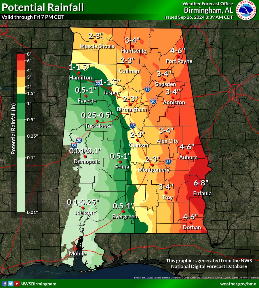
* FLOODING RAIN
– LATEST LOCAL FORECAST: Flood Watch is in effect
– Peak Rainfall Amounts: Additional 3-6 inches, with locally higher amounts
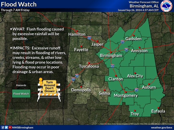
– THREAT TO LIFE AND PROPERTY THAT INCLUDES TYPICAL FORECAST
UNCERTAINTY IN TRACK, SIZE AND INTENSITY: Potential for major flooding rain
– The flooding rain threat has remained nearly steady from the previous assessment.
– PLAN: Emergency plans should include the potential for major flooding from heavy rain. Evacuations and rescues are likely.
– PREPARE: Strongly consider protective actions, especially if you are in an area vulnerable to flooding.
– ACT: Heed any flood watches and warnings. Failure to take action will likely result in serious injury or loss of life.
– POTENTIAL IMPACTS: Extensive
– Major rainfall flooding may prompt many evacuations and rescues.
– Rivers and tributaries may rapidly overflow their banks in multiple places. Small streams, creeks, and ditches may become dangerous rivers. Flood control systems and barriers may become stressed.
– Flood waters can enter many structures within multiple communities, some structures becoming uninhabitable or washed away. Streets and parking lots become rivers of moving water with underpasses submerged. Driving conditions become dangerous. Many road and bridge closures with some weakened or washed out.
* TORNADO
– LATEST LOCAL FORECAST:
– Situation is unfavorable for tornadoes
– THREAT TO LIFE AND PROPERTY THAT INCLUDES TYPICAL FORECAST UNCERTAINTY IN TRACK, SIZE AND INTENSITY: Tornadoes not expected
– The tornado threat has remained nearly steady from the previous assessment.
– PLAN: Tornadoes are not expected. Showers and thunderstorms with gusty winds may still occur.
– PREPARE: Little to no preparations needed to protect against tornadoes at this time. Keep informed of the latest tornado situation.
– ACT: Listen for changes in the forecast.
– POTENTIAL IMPACTS: Little to None
– Little to no potential impacts from tornadoes.
* FOR MORE INFORMATION:
– http://ready.gov/hurricanes