Flood Watch/National Weather Service Birmingham AL
Etowah-Calhoun-Cherokee-Cleburne-St. Clair-Talladega-Clay-Randolph-Coosa-Tallapoosa-Chambers-Elmore-Montgomery-Macon-Bullock-Lee-Russell-Pike-Barbour-Including the cities of Phenix City, Moody, Alexander City, Pell City, Montgomery, Dadeville, Rockford, Ashland, Tallassee, Centre, Auburn, Wetumpka, Gadsden, Lafayette, Talladega, Roanoke, Union Springs, Tuskegee, Sylacauga, Lanett, Heflin, Anniston, Valley, Troy, Opelika, and Eufaula
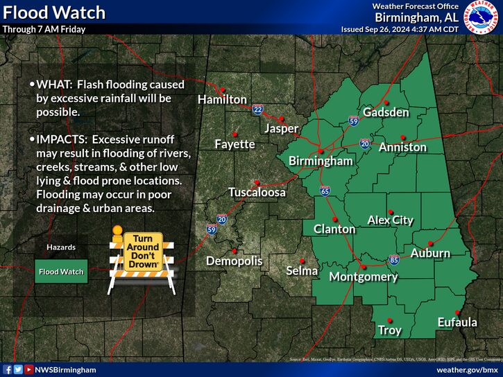
FLOOD WATCH REMAINS IN EFFECT THROUGH FRIDAY MORNING
* WHAT
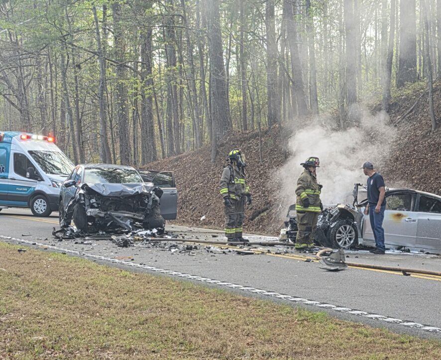
Flash flooding caused by excessive rainfall continues to be possible.
* WHERE
A portion of central Alabama, including the following counties, Barbour, Bullock, Calhoun, Chambers, Cherokee, Clay, Cleburne, Coosa, Elmore, Etowah, Lee, Macon, Montgomery, Pike, Randolph, Russell, St. Clair, Talladega and Tallapoosa.
* WHEN
Through Friday morning.
* IMPACTS
Excessive runoff may result in flooding of rivers, creeks, streams, and other low-lying and flood-prone locations.
* ADDITIONAL DETAILS
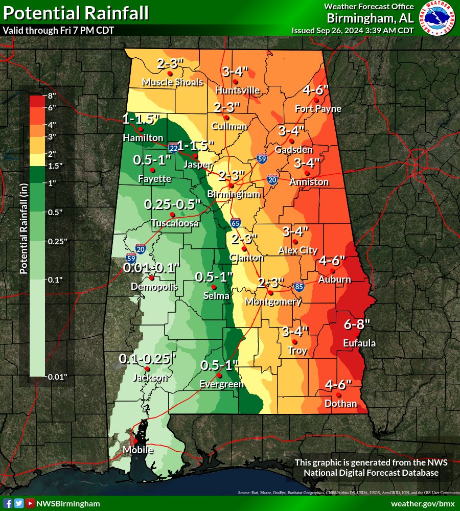
Locally heavy rainfall will continue through Thursday night as Helene approaches the area. Rainfall amounts of 4 to 8 inches will result in river flooding and flash flooding, some of which may be locally significant.
– http://www.weather.gov/safety/flood
PRECAUTIONARY/PREPAREDNESS ACTIONS
You should monitor forecasts and also be prepared to take action should Flash Flood Warnings be issued.